Huixquilucan night lights from space
Night Light of Huixquilucan (México) from space (Mexico) Src. Average luminocity for 10x10km area is 72.5351% and for 50x50km: 59.2896%.
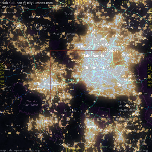

Analysis of Huixquilucan night lights 2016
Square area 10x10 km:
 11.78%
90-99
13.02%80-89
18.6%70-79
17.98%60-69
11.98%50-59
5.58%40-49
10.74%30-39
6.4%20-29
3.93%10-19
0%0-9
0%Square area 50x50 km:
23.59%90-99
7.49%80-89
7.37%70-79
8.02%60-69
9.02%50-59
4.86%40-49
5.89%30-39
4.72%20-29
7.95%10-19
7.89%0-9
13.19%Clear (daylight) street map image can be seen on geolist.org.
Map coordinates:
20° 1' 18.7" North, 100° 3' 11.8" West
19° 21' 35.5" North, 99° 21' 0.6" West
18° 41' 42.5" North, 98° 38' 49.3" West
Some cities around Huixquilucan sort by population:
• Delegación Cuajimalpa de Morelos
6.3 km =3.9 mi,  80°
80°
• Jesús del Monte
6.1 km =3.8 mi,  73°
73°
• San Lorenzo Acopilco
4.1 km =2.5 mi,  144°
144°
• Col. Bosques de las Lomas
9.1 km =5.7 mi, 76°
• La Magdalena Chichicaspa
6.4 km =4 mi,  23°
23°
• Santiago Yancuitlalpan
5.5 km =3.4 mi,  60°
60°
• Zacamulpa
2 km =1.2 mi,  103°
103°
• San Bartolomé Coatepec
5.8 km =3.6 mi,  43°
43°
3827414 (p: 124,846)
Sources (retrieved 2019-11-25):
» NASA, Earths city lights 1995
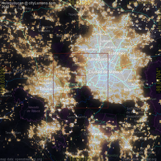
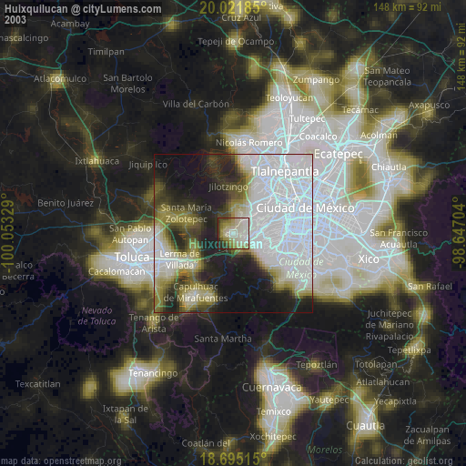
» NASA city lights 2003
» Earth at Night: Flat Maps 2012, 2016