Sveti Nikole night lights from space
Night Light of Sveti Nikole from space (North Macedonia) Src. Average luminocity for 10x10km area is 3.2254% and for 50x50km: 2.7272%.
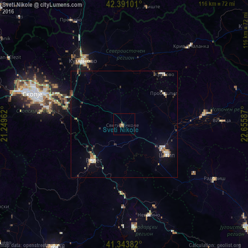
Analysis of Sveti Nikole night lights 2016
Square area 10x10 km:
 0%
0%90-99
0%80-89
0.63%70-79
0%60-69
2.38%50-59
0.79%40-49
0.63%30-39
0%20-29
0%10-19
0%0-9
95.56%Square area 50x50 km:
0.17%90-99
0.5%80-89
0.36%70-79
0.32%60-69
0.27%50-59
0.36%40-49
0.37%30-39
0.43%20-29
0.31%10-19
1.41%0-9
95.49%Clear (daylight) street map image can be seen on geolist.org.
Map coordinates:
42° 23' 27.6" North, 21° 14' 58.6" East
41° 52' 10.4" North, 21° 57' 9.9" East
41° 20' 37.8" North, 22° 39' 21.1" East
Some cities around Sveti Nikole sort by population:
• Veles
22.6 km =14 mi,  220°
220°
• Shtip
24.4 km =15.2 mi,  124°
124°
• Probishtip
23.9 km =14.9 mi,  51°
51°
• Kratovo
29.9 km =18.6 mi,  39°
39°
• Петровец
29 km =18 mi,  285°
285°
• Zelenikovo
30.2 km =18.8 mi,  273°
273°
• Karbinci
24.1 km =15 mi,  103°
103°
• Lozovo
10.3 km =6.4 mi,  202°
202°
785201 (p: 13,292)
Sources (retrieved 2019-11-25):
» Earth at Night: Flat Maps 2012, 2016