Sîngera night lights from space
Night Light of Sîngera (Chișinău Municipality) from space (Moldova) Src. Average luminocity for 10x10km area is 13.5789% and for 50x50km: 8.0877%.
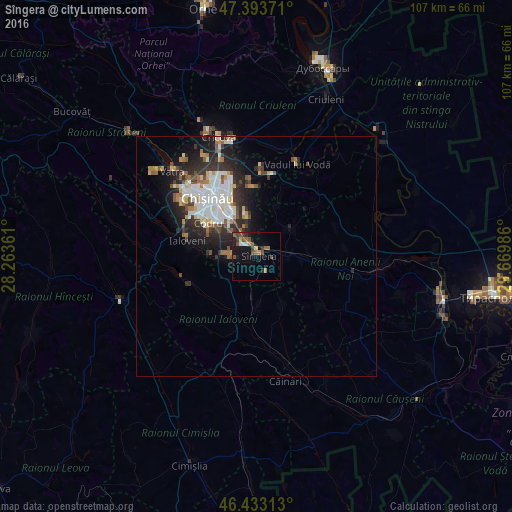
Analysis of Sîngera night lights 2016
Square area 10x10 km:
 0.74%
0.74%90-99
1.04%80-89
1.04%70-79
0.89%60-69
2.53%50-59
3.57%40-49
5.06%30-39
1.64%20-29
2.08%10-19
11.01%0-9
70.39%Square area 50x50 km:
1.56%90-99
1.83%80-89
0.77%70-79
0.6%60-69
0.96%50-59
0.87%40-49
1%30-39
1.12%20-29
3%10-19
4.13%0-9
84.15%Clear (daylight) street map image can be seen on geolist.org.
Map coordinates:
47° 23' 37.4" North, 28° 15' 49" East
46° 54' 56.1" North, 28° 58' 0.2" East
46° 25' 59.3" North, 29° 40' 11.5" East
Some cities around Sîngera sort by population:
• Chisinau
13 km =8.1 mi,  320°
320°
• Hînceşti
30.1 km =18.7 mi,  251°
251°
• Ialoveni
14.3 km =8.9 mi,  282°
282°
• Anenii Noi
20.8 km =12.9 mi,  101°
101°
• Cricova
26 km =16.2 mi,  342°
342°
• Ciorescu
24.6 km =15.3 mi,  346°
346°
• Stăuceni
21.5 km =13.4 mi, 339°
• Vadul lui Vodă
21.1 km =13.1 mi,  23°
23°
617279 (p: 7,200)
Sources (retrieved 2019-11-25):
» Earth at Night: Flat Maps 2012, 2016