Valmiera night lights from space
Night Light of Valmiera from space (Latvia) Src. Average luminocity for 10x10km area is 21.8262% and for 50x50km: 1.0754%.
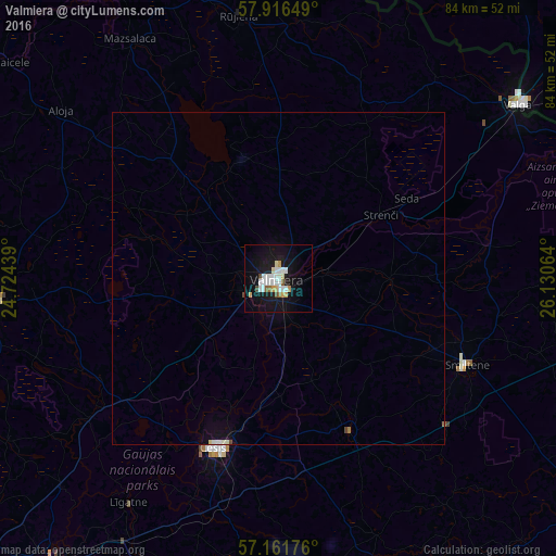
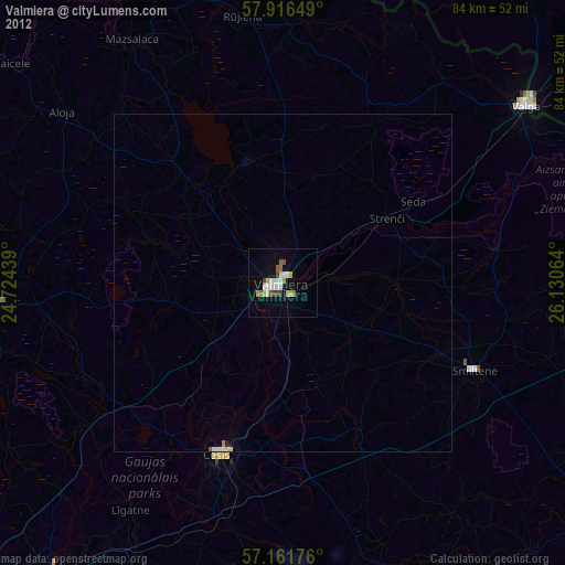
Analysis of Valmiera night lights 2016
Square area 10x10 km:
100  5.12%
5.12%
90-99 5.6%
80-89 1.79%
70-79 2.5%
60-69 1.07%
50-59 1.07%
40-49 1.31%
30-39 0.12%
20-29 0.36%
10-19 28.21%
0-9 52.86%
5.12%90-99
5.6%80-89
1.79%70-79
2.5%60-69
1.07%50-59
1.07%40-49
1.31%30-39
0.12%20-29
0.36%10-19
28.21%0-9
52.86%Square area 50x50 km:
100 0.22%
90-99 0.24%
80-89 0.08%
70-79 0.1%
60-69 0.06%
50-59 0.05%
40-49 0.1%
30-39 0%
20-29 0.01%
10-19 1.23%
0-9 97.9%
0.22%90-99
0.24%80-89
0.08%70-79
0.1%60-69
0.06%50-59
0.05%40-49
0.1%30-39
0%20-29
0.01%10-19
1.23%0-9
97.9%Clear (daylight) street map image can be seen on geolist.org.
Map coordinates:
57° 54' 59.4" North, 24° 43' 27.8" East
57° 32' 27.9" North, 25° 25' 39" East
57° 9' 42.3" North, 26° 7' 50.3" East
Some cities around Valmiera sort by population:
• Cēsis
27.1 km =16.8 mi,  199°
199°
• Priekuļi
25.4 km =15.8 mi,  188°
188°
• Strenči
18 km =11.2 mi,  58°
58°
• Stalbe
30.4 km =18.9 mi,  231°
231°
• Rauna
25.7 km =16 mi,  154°
154°
• Matīši
23.7 km =14.7 mi,  317°
317°
• Mūrmuiža
8.5 km =5.3 mi, 153°
• Kocēni
5.8 km =3.6 mi,  246°
246°
453754 (p: 26,963)
Sources (retrieved 2019-11-25):
» Earth at Night: Flat Maps 2012, 2016