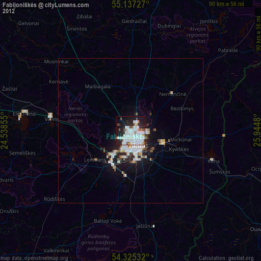
Fabijoniškės night lights from space
Night Light of Fabijoniškės (Vilnius) from space (Lithuania) Src. Average luminocity for 10x10km area is 67.2281% and for 50x50km: 8.7063%.
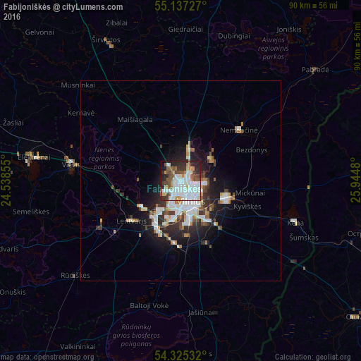
Analysis of Fabijoniškės night lights 2016
Square area 10x10 km:
 22.43%
90-99
21.68%80-89
3.26%70-79
4.89%60-69
4.26%50-59
8.9%40-49
6.89%30-39
6.77%20-29
14.04%10-19
5.76%0-9
1.13%Square area 50x50 km:
2.15%90-99
1.95%80-89
0.62%70-79
0.83%60-69
0.63%50-59
1.04%40-49
0.95%30-39
1.21%20-29
2.23%10-19
4.88%0-9
83.51%Clear (daylight) street map image can be seen on geolist.org.
Map coordinates:
55° 8' 14.2" North, 24° 32' 18.8" East
54° 43' 60" North, 25° 14' 30" East
54° 19' 31.2" North, 25° 56' 41.3" East
Some cities around Fabijoniškės sort by population:
• Vilnius
5.5 km =3.4 mi,  153°
153°
• Pašilaičiai
1.5 km =0.9 mi,  274°
274°
• Šeškinė
2.7 km =1.7 mi,  167°
167°
• Justiniškės
2.4 km =1.5 mi,  220°
220°
• Naujamiestis
6.2 km =3.9 mi,  163°
163°
• Vilkpėdė
7.1 km =4.4 mi,  176°
176°
• Pilaitė
5.3 km =3.3 mi, 224°
• Rasos
7.6 km =4.7 mi,  143°
143°
596479 (p: 39,759)
Sources (retrieved 2019-11-25):
» Earth at Night: Flat Maps 2012, 2016