Gapyeong night lights from space
Night Light of Gapyeong (Gyeonggi-do) from space (South Korea) Src. Average luminocity for 10x10km area is 10.1276% and for 50x50km: 15.1154%.
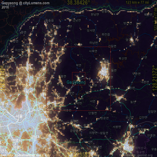
Analysis of Gapyeong night lights 2016
Square area 10x10 km:
 0%
0%90-99
0.34%80-89
2.89%70-79
1.53%60-69
0.68%50-59
0.68%40-49
1.36%30-39
2.72%20-29
7.14%10-19
0.34%0-9
82.31%Square area 50x50 km:
0.82%90-99
1.45%80-89
1.63%70-79
1.75%60-69
2.55%50-59
3.31%40-49
2.77%30-39
4.45%20-29
6.11%10-19
10.09%0-9
65.06%Clear (daylight) street map image can be seen on geolist.org.
Map coordinates:
38° 23' 3.3" North, 126° 48' 26.9" East
37° 49' 51.6" North, 127° 30' 38.1" East
37° 16' 24.9" North, 128° 12' 49.4" East
Some cities around Gapyeong sort by population:
• Chuncheon
20.2 km =12.6 mi,  76°
76°
• Yangju
39.4 km =24.5 mi,  270°
270°
• Hwado
26.7 km =16.6 mi,  221°
221°
• Wabu
37 km =23 mi, 223°
• Namyangju
33.9 km =21.1 mi,  230°
230°
• Yangp'yŏng
38 km =23.6 mi,  182°
182°
• Hongch’ŏn
36.4 km =22.6 mi,  115°
115°
• Hwacheon
35.2 km =21.9 mi,  29°
29°
1843082 (p: 55,415)
Sources (retrieved 2019-11-25):
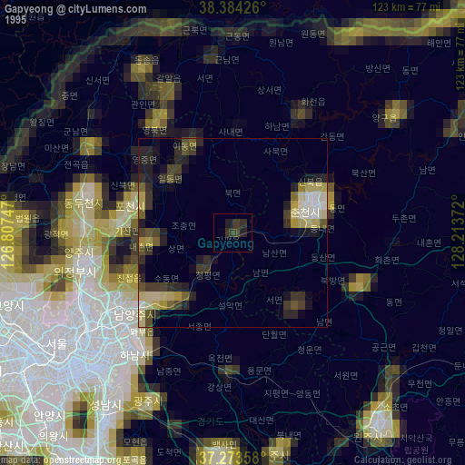
» NASA, Earths city lights 1995
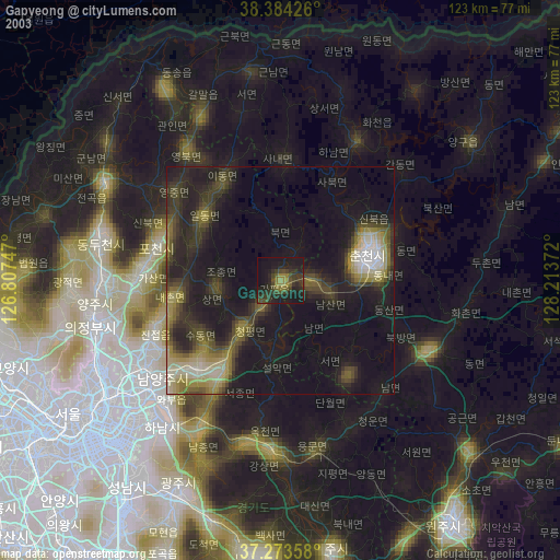
» NASA city lights 2003
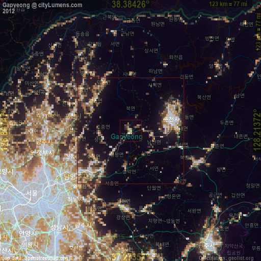
» Earth at Night: Flat Maps 2012, 2016