Anjō night lights from space
Night Light of Anjō (Aichi) from space (Japan) Src. Average luminocity for 10x10km area is 81.7784% and for 50x50km: 52.2182%.
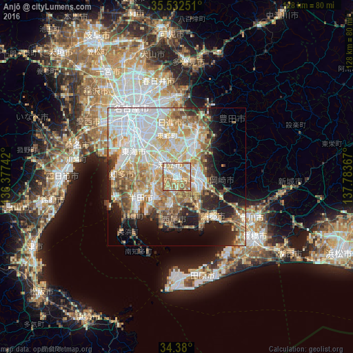
Analysis of Anjō night lights 2016
Square area 10x10 km:
 16.3%
16.3%90-99
18.5%80-89
17.77%70-79
23.99%60-69
20.88%50-59
2.01%40-49
0.55%30-39
0%20-29
0%10-19
0%0-9
0%Square area 50x50 km:
13.79%90-99
11.44%80-89
7.36%70-79
7.37%60-69
9.15%50-59
5.87%40-49
4.32%30-39
4.07%20-29
6.08%10-19
8.83%0-9
21.72%Clear (daylight) street map image can be seen on geolist.org.
Map coordinates:
35° 31' 57" North, 136° 22' 38.7" East
34° 57' 29.8" North, 137° 4' 49.9" East
34° 22' 48" North, 137° 47' 1.2" East
Some cities around Anjō sort by population:
• Toyota
15.3 km =9.5 mi,  24°
24°
• Okazaki
7.9 km =4.9 mi,  96°
96°
• Kariya
9.3 km =5.8 mi,  287°
287°
• Nishio
10.6 km =6.6 mi,  195°
195°
• Ōbu
13.6 km =8.5 mi,  298°
298°
• Hekinan
12.2 km =7.6 mi,  226°
226°
• Chiryū
6.3 km =3.9 mi,  317°
317°
• Takahama
10 km =6.2 mi,  242°
242°
1865294 (p: 178,402)
Sources (retrieved 2019-11-25):
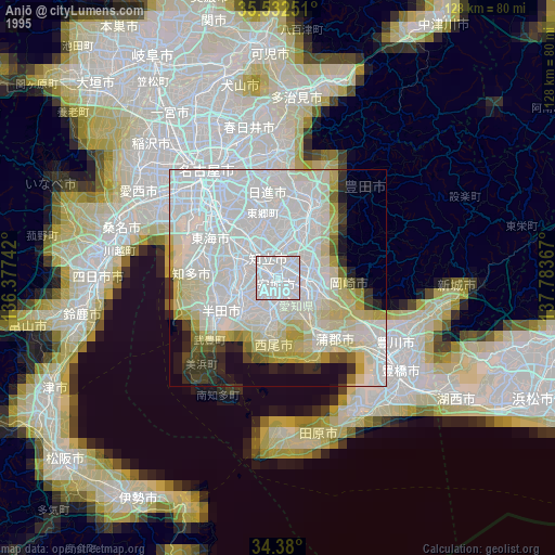
» NASA, Earths city lights 1995
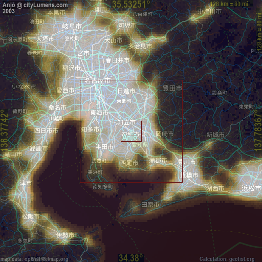
» NASA city lights 2003
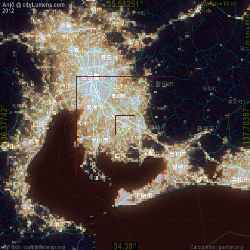
» Earth at Night: Flat Maps 2012, 2016