Villabate night lights from space
Night Light of Villabate (Sicily) from space (Italy) Src. Average luminocity for 10x10km area is 53.5308% and for 50x50km: 16.3373%.
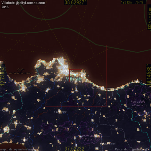
Analysis of Villabate night lights 2016
Square area 10x10 km:
 7.31%
7.31%90-99
8.77%80-89
9.74%70-79
3.9%60-69
5.19%50-59
12.18%40-49
13.15%30-39
13.8%20-29
22.24%10-19
3.73%0-9
0%Square area 50x50 km:
2.81%90-99
2.45%80-89
1.92%70-79
1.51%60-69
2.21%50-59
2.44%40-49
1.97%30-39
2.84%20-29
5.11%10-19
10.97%0-9
65.77%Clear (daylight) street map image can be seen on geolist.org.
Map coordinates:
38° 37' 45.4" North, 12° 44' 22.7" East
38° 4' 40.4" North, 13° 26' 33.9" East
37° 31' 20.4" North, 14° 8' 45.2" East
Some cities around Villabate sort by population:
• Bagheria
6.1 km =3.8 mi,  88°
88°
• Misilmeri
5.1 km =3.2 mi,  174°
174°
• Ficarazzi
2.4 km =1.5 mi,  49°
49°
• Belmonte Mezzagno
5.6 km =3.5 mi,  231°
231°
• Casteldaccia
8.2 km =5.1 mi,  111°
111°
• Santa Flavia
8.5 km =5.3 mi,  69°
69°
• Ciaculli
3.1 km =1.9 mi,  264°
264°
• Altavilla Milicia
10.3 km =6.4 mi,  115°
115°
2522767 (p: 19,031)
Sources (retrieved 2019-11-25):
» Earth at Night: Flat Maps 2012, 2016