Trebaseleghe night lights from space
Night Light of Trebaseleghe (Veneto) from space (Italy) Src. Average luminocity for 10x10km area is 49.603% and for 50x50km: 57.0503%.
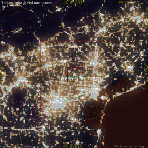
Analysis of Trebaseleghe night lights 2016
Square area 10x10 km:
 3.79%
3.79%90-99
7.12%80-89
3.79%70-79
6.52%60-69
7.42%50-59
10.15%40-49
22.73%30-39
14.24%20-29
23.33%10-19
0.91%0-9
0%Square area 50x50 km:
9.4%90-99
11.23%80-89
5.75%70-79
6.58%60-69
10.43%50-59
13.41%40-49
11.63%30-39
10.05%20-29
13.97%10-19
6.3%0-9
1.26%Clear (daylight) street map image can be seen on geolist.org.
Map coordinates:
46° 4' 58.1" North, 11° 20' 26.9" East
45° 35' 34.6" North, 12° 2' 38.1" East
45° 5' 55.6" North, 12° 44' 49.4" East
Some cities around Trebaseleghe sort by population:
• Noale
5.5 km =3.4 mi,  162°
162°
• Camposampiero
9.1 km =5.7 mi,  248°
248°
• Scorzè
5.7 km =3.5 mi,  111°
111°
• Salzano
9.1 km =5.7 mi,  150°
150°
• Martellago
10.8 km =6.7 mi,  120°
120°
• Quinto di Treviso
11 km =6.8 mi,  59°
59°
• Borgoricco-San Michele delle Badesse-Sant'Eufemia
10.3 km =6.4 mi,  231°
231°
• Zero Branco
9.4 km =5.8 mi,  85°
85°
3165286 (p: 7,901)
Sources (retrieved 2019-11-25):
» Earth at Night: Flat Maps 2012, 2016