Staranzano night lights from space
Night Light of Staranzano (Friuli Venezia Giulia) from space (Italy) Src. Average luminocity for 10x10km area is 45.3765% and for 50x50km: 16.3466%.
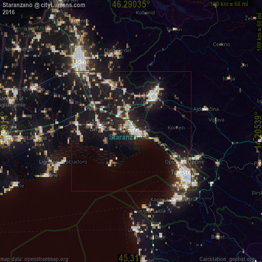
Analysis of Staranzano night lights 2016
Square area 10x10 km:
 9.52%
9.52%90-99
11.16%80-89
5.06%70-79
4.17%60-69
4.76%50-59
4.46%40-49
3.42%30-39
1.64%20-29
23.96%10-19
27.38%0-9
4.46%Square area 50x50 km:
2.28%90-99
3.09%80-89
1.46%70-79
1.4%60-69
1.58%50-59
1.84%40-49
2.26%30-39
2.29%20-29
5.34%10-19
19.54%0-9
58.91%Clear (daylight) street map image can be seen on geolist.org.
Map coordinates:
46° 17' 25.3" North, 12° 47' 56.9" East
45° 48' 8.4" North, 13° 30' 8.1" East
45° 18' 36" North, 14° 12' 19.4" East
Some cities around Staranzano sort by population:
• Monfalcone
2.4 km =1.5 mi,  83°
83°
• Cervignano del Friuli
12.8 km =8 mi,  279°
279°
• Ronchi dei Legionari
2.8 km =1.7 mi,  3°
3°
• Grado
15.8 km =9.8 mi,  209°
209°
• Gradisca d'Isonzo
10 km =6.2 mi,  359°
359°
• Cormons
17.2 km =10.7 mi,  350°
350°
• Šempeter pri Gorici, SI
17.6 km =10.9 mi,  37°
37°
• Miren, SI
13.2 km =8.2 mi, 38°
3166193 (p: 6,803)
Sources (retrieved 2019-11-25):
» Earth at Night: Flat Maps 2012, 2016