Santa Maria Capua Vetere night lights from space
Night Light of Santa Maria Capua Vetere (Campania) from space (Italy) Src. Average luminocity for 10x10km area is 66.6023% and for 50x50km: 44.0136%.
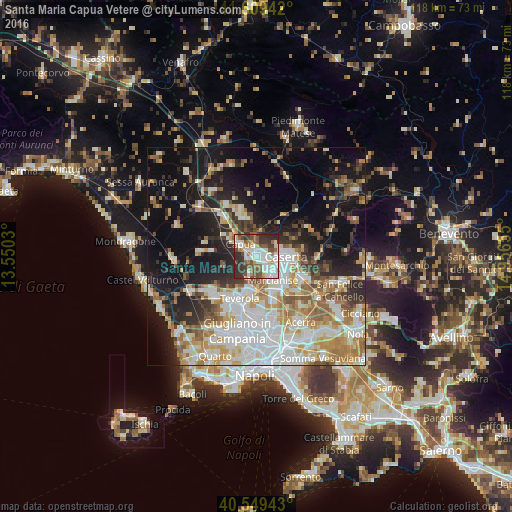
Analysis of Santa Maria Capua Vetere night lights 2016
Square area 10x10 km:
 17.86%
90-99
18.18%80-89
5.68%70-79
4.71%60-69
6.33%50-59
12.01%40-49
10.55%30-39
13.64%20-29
11.04%10-19
0%0-9
0%Square area 50x50 km:
10.12%90-99
10.22%80-89
4.39%70-79
5.56%60-69
6.42%50-59
5.34%40-49
3.76%30-39
4.53%20-29
8.46%10-19
18.9%0-9
22.3%Clear (daylight) street map image can be seen on geolist.org.
Map coordinates:
41° 36' 33.9" North, 13° 33' 1.1" East
41° 4' 53.6" North, 14° 15' 12.3" East
40° 32' 57.9" North, 14° 57' 23.6" East
Some cities around Santa Maria Capua Vetere sort by population:
• Capua
4.3 km =2.7 mi,  307°
307°
• Casagiove
5 km =3.1 mi,  103°
103°
• San Prisco
2 km =1.2 mi,  76°
76°
• Macerata Campania
2.9 km =1.8 mi,  135°
135°
• Casapulla
3.1 km =1.9 mi, 100°
• Recale
5 km =3.1 mi,  123°
123°
• Portico di Caserta
3.7 km =2.3 mi, 142°
• Curti
2.3 km =1.4 mi, 104°
3167561 (p: 31,743)
Sources (retrieved 2019-11-25):
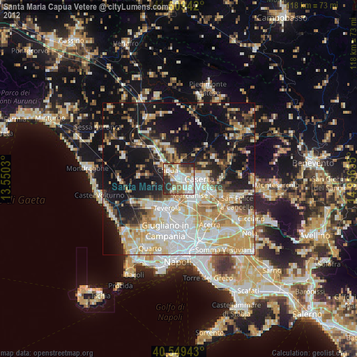
» Earth at Night: Flat Maps 2012, 2016