San Pietro a Patierno night lights from space
Night Light of San Pietro a Patierno (Campania) from space (Italy) Src. Average luminocity for 10x10km area is 99.233% and for 50x50km: 52.1626%.
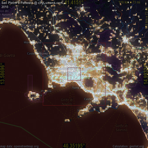
Analysis of San Pietro a Patierno night lights 2016
Square area 10x10 km:
 74.83%
90-99
22.11%80-89
2.55%70-79
0.51%60-69
0%50-59
0%40-49
0%30-39
0%20-29
0%10-19
0%0-9
0%Square area 50x50 km:
13.75%90-99
13.24%80-89
5.35%70-79
7.22%60-69
7.76%50-59
5.18%40-49
3.77%30-39
6.1%20-29
9.13%10-19
10.74%0-9
17.76%Clear (daylight) street map image can be seen on geolist.org.
Map coordinates:
41° 24' 54.4" North, 13° 35' 13.1" East
40° 53' 8.4" North, 14° 17' 24.3" East
40° 21' 7" North, 14° 59' 35.6" East
Some cities around San Pietro a Patierno sort by population:
• San Carlo All'Arena
3.2 km =2 mi,  224°
224°
• Casoria
2.4 km =1.5 mi,  5°
5°
• Secondigliano
2.5 km =1.6 mi,  309°
309°
• Miano
3.1 km =1.9 mi,  275°
275°
• Poggioreale
2.3 km =1.4 mi,  182°
182°
• Arpino
2.6 km =1.6 mi,  82°
82°
• Casavatore
1.9 km =1.2 mi,  323°
323°
• Vicaria
3 km =1.9 mi,  207°
207°
12070069 (p: 17,324)
Sources (retrieved 2019-11-25):
» Earth at Night: Flat Maps 2012, 2016