Salemi night lights from space
Night Light of Salemi (Sicily) from space (Italy) Src. Average luminocity for 10x10km area is 12.8401% and for 50x50km: 13.8881%.
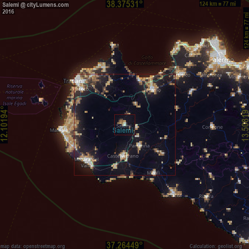
Analysis of Salemi night lights 2016
Square area 10x10 km:
 0.68%
0.68%90-99
1.02%80-89
1.36%70-79
1.7%60-69
1.36%50-59
2.04%40-49
4.08%30-39
1.02%20-29
1.7%10-19
1.53%0-9
83.5%Square area 50x50 km:
1.3%90-99
1.4%80-89
2.05%70-79
1.59%60-69
2.02%50-59
2.08%40-49
1.78%30-39
2.29%20-29
3.7%10-19
12.29%0-9
69.5%Clear (daylight) street map image can be seen on geolist.org.
Map coordinates:
38° 22' 31.1" North, 12° 6' 7" East
37° 49' 19.2" North, 12° 48' 18.2" East
37° 15' 52.2" North, 13° 30' 29.5" East
Some cities around Salemi sort by population:
• Mazara del Vallo
26.5 km =16.5 mi,  225°
225°
• Alcamo
22.3 km =13.9 mi,  38°
38°
• Castelvetrano
15.7 km =9.8 mi,  184°
184°
• Castellammare del Golfo
23.7 km =14.7 mi,  16°
16°
• Partanna
12.9 km =8 mi,  145°
145°
• Campobello di Mazara
21.4 km =13.3 mi,  193°
193°
• Paceco
27.9 km =17.3 mi,  309°
309°
• Santa Margherita di Belice
23.4 km =14.5 mi,  127°
127°
2523557 (p: 7,788)
Sources (retrieved 2019-11-25):
» Earth at Night: Flat Maps 2012, 2016