Rodengo-Saiano night lights from space
Night Light of Rodengo-Saiano (Lombardy) from space (Italy) Src. Average luminocity for 10x10km area is 60.8061% and for 50x50km: 38.8067%.
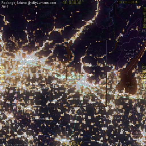
Analysis of Rodengo-Saiano night lights 2016
Square area 10x10 km:
 9.55%
9.55%90-99
10.91%80-89
3.94%70-79
9.7%60-69
17.73%50-59
15.61%40-49
8.33%30-39
10.45%20-29
12.27%10-19
1.52%0-9
0%Square area 50x50 km:
6.94%90-99
7.87%80-89
3.11%70-79
3.52%60-69
5.24%50-59
6.71%40-49
6.46%30-39
7.89%20-29
12.25%10-19
18.23%0-9
21.78%Clear (daylight) street map image can be seen on geolist.org.
Map coordinates:
46° 5' 21.8" North, 9° 24' 14.6" East
45° 35' 58.5" North, 10° 6' 25.8" East
45° 6' 19.7" North, 10° 48' 37.1" East
Some cities around Rodengo-Saiano sort by population:
• Gussago
4.3 km =2.7 mi,  114°
114°
• Piazza
4 km =2.5 mi, 110°
• Ospitaletto
5.8 km =3.6 mi,  204°
204°
• Villa Carcina
7.8 km =4.8 mi,  61°
61°
• Ponte Cingoli
0.2 km =0.1 mi,  185°
185°
• Castegnato
4.3 km =2.7 mi,  172°
172°
• Provaglio d'Iseo
6.3 km =3.9 mi,  309°
309°
• Passirano
2.9 km =1.8 mi,  263°
263°
6534749 (p: 7,507)
Sources (retrieved 2019-11-25):
» Earth at Night: Flat Maps 2012, 2016