Leverano night lights from space
Night Light of Leverano (Apulia) from space (Italy) Src. Average luminocity for 10x10km area is 29.9133% and for 50x50km: 25.2987%.
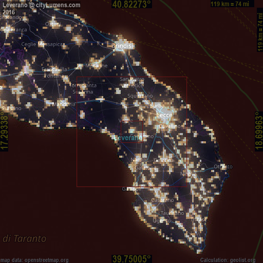
Analysis of Leverano night lights 2016
Square area 10x10 km:
 2.89%
2.89%90-99
4.59%80-89
1.36%70-79
5.61%60-69
2.72%50-59
4.08%40-49
2.72%30-39
4.25%20-29
17.86%10-19
39.29%0-9
14.63%Square area 50x50 km:
2.96%90-99
4.5%80-89
3.04%70-79
2.88%60-69
3.24%50-59
2.82%40-49
2.83%30-39
4.25%20-29
12.97%10-19
18.9%0-9
41.61%Clear (daylight) street map image can be seen on geolist.org.
Map coordinates:
40° 49' 21.8" North, 17° 17' 36.2" East
40° 17' 18.7" North, 17° 59' 47.4" East
39° 45' 0.2" North, 18° 41' 58.7" East
Some cities around Leverano sort by population:
• Copertino
5.4 km =3.4 mi,  114°
114°
• Veglie
5.9 km =3.7 mi,  330°
330°
• Monteroni di Lecce
8.8 km =5.5 mi,  67°
67°
• Campi Salentina
12.3 km =7.6 mi,  9°
9°
• Carmiano
7.3 km =4.5 mi,  31°
31°
• Salice Salentino
11.1 km =6.9 mi,  344°
344°
• Lequile
12.3 km =7.6 mi,  81°
81°
• Novoli
10.7 km =6.6 mi,  23°
23°
3174789 (p: 13,643)
Sources (retrieved 2019-11-25):
» Earth at Night: Flat Maps 2012, 2016