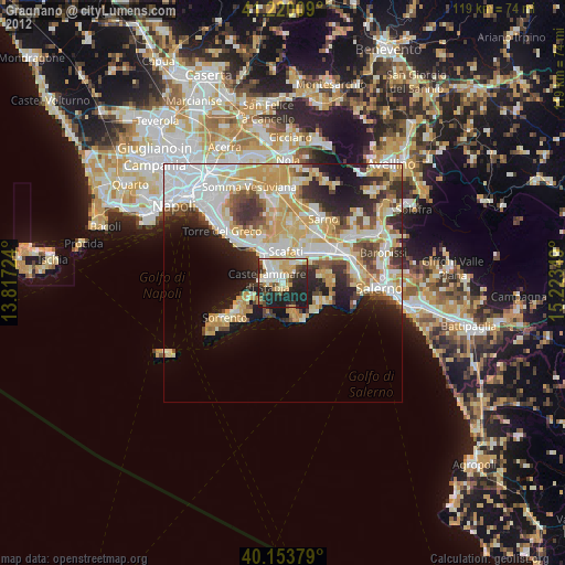
Gragnano night lights from space
Night Light of Gragnano (Campania) from space (Italy) Src. Average luminocity for 10x10km area is 52.0373% and for 50x50km: 34.107%.
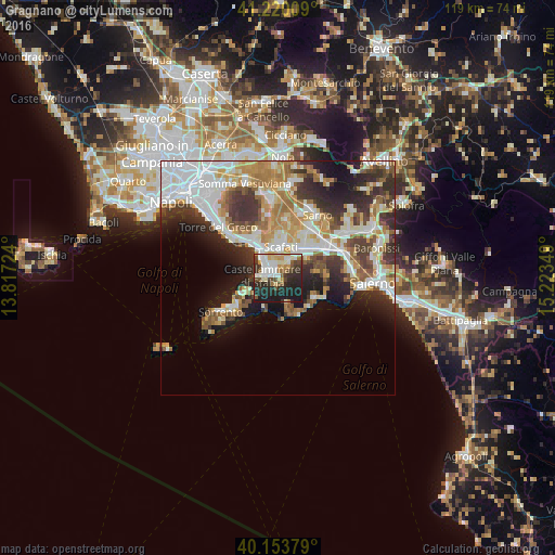
Analysis of Gragnano night lights 2016
Square area 10x10 km:
 11.36%
90-99
11.53%80-89
6.49%70-79
5.84%60-69
4.38%50-59
5.68%40-49
6.33%30-39
7.63%20-29
21.59%10-19
19.16%0-9
0%Square area 50x50 km:
7.82%90-99
7.74%80-89
3.69%70-79
4.45%60-69
5.14%50-59
3.93%40-49
3.14%30-39
5.88%20-29
7.31%10-19
8.8%0-9
42.1%Clear (daylight) street map image can be seen on geolist.org.
Map coordinates:
41° 13' 12.3" North, 13° 49' 2.1" East
40° 41' 20.7" North, 14° 31' 13.3" East
40° 9' 13.6" North, 15° 13' 24.6" East
Some cities around Gragnano sort by population:
• Castellammare di Stabia
3.2 km =2 mi,  297°
297°
• Pompei
6.6 km =4.1 mi,  342°
342°
• Sant'Antonio Abate
4 km =2.5 mi,  24°
24°
• Santa Maria La Carità
3.1 km =1.9 mi, 343°
• Agerola
5.9 km =3.7 mi,  164°
164°
• Pianillo
6.6 km =4.1 mi, 158°
• Pimonte
1.9 km =1.2 mi,  207°
207°
• Lettere
2.7 km =1.7 mi,  49°
49°
3175952 (p: 29,082)
Sources (retrieved 2019-11-25):
» Earth at Night: Flat Maps 2012, 2016