Eboli night lights from space
Night Light of Eboli (Campania) from space (Italy) Src. Average luminocity for 10x10km area is 44.4188% and for 50x50km: 18.1276%.
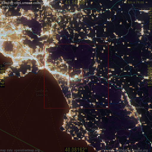
Analysis of Eboli night lights 2016
Square area 10x10 km:
 4.06%
4.06%90-99
7.63%80-89
6.01%70-79
2.27%60-69
5.52%50-59
11.36%40-49
9.25%30-39
13.8%20-29
19.48%10-19
20.62%0-9
0%Square area 50x50 km:
1.86%90-99
2.65%80-89
2.1%70-79
1.97%60-69
2.12%50-59
3.6%40-49
2.85%30-39
4.43%20-29
6.21%10-19
10.45%0-9
61.76%Clear (daylight) street map image can be seen on geolist.org.
Map coordinates:
41° 8' 56.6" North, 14° 21' 13.7" East
40° 37' 2.9" North, 15° 3' 24.9" East
40° 4' 53.8" North, 15° 45' 36.2" East
Some cities around Eboli sort by population:
• Battipaglia
6.4 km =4 mi,  261°
261°
• Giffoni Valle Piana
14.8 km =9.2 mi,  319°
319°
• Bellizzi
9.3 km =5.8 mi,  271°
271°
• Mercato
14.7 km =9.1 mi, 318°
• Montecorvino Rovella
10.6 km =6.6 mi, 321°
• Montecorvino Pugliano
11.7 km =7.3 mi,  305°
305°
• Olevano sul Tusciano
5.3 km =3.3 mi,  327°
327°
• Quadrivio
4 km =2.5 mi,  78°
78°
3177438 (p: 26,183)
Sources (retrieved 2019-11-25):
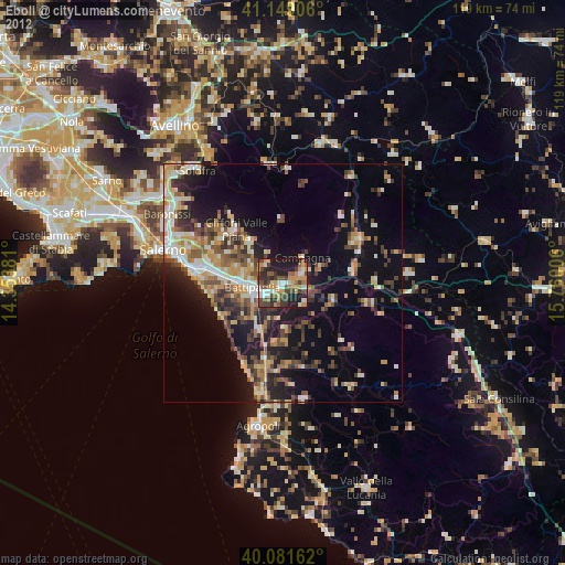
» Earth at Night: Flat Maps 2012, 2016