Capaci night lights from space
Night Light of Capaci (Sicily) from space (Italy) Src. Average luminocity for 10x10km area is 52.051% and for 50x50km: 17.9702%.
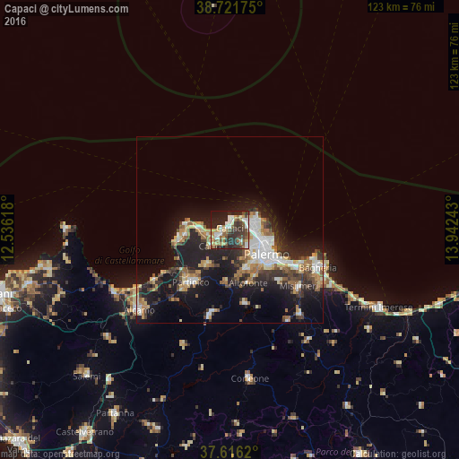
Analysis of Capaci night lights 2016
Square area 10x10 km:
 7.82%
7.82%90-99
9.69%80-89
7.65%70-79
4.93%60-69
8.16%50-59
7.99%40-49
9.35%30-39
11.73%20-29
21.77%10-19
10.88%0-9
0%Square area 50x50 km:
2.89%90-99
2.65%80-89
2.13%70-79
2.03%60-69
2.37%50-59
2.49%40-49
2.23%30-39
3.09%20-29
6.14%10-19
13.62%0-9
60.35%Clear (daylight) street map image can be seen on geolist.org.
Map coordinates:
38° 43' 18.3" North, 12° 32' 10.2" East
38° 10' 15.9" North, 13° 14' 21.5" East
37° 36' 58.3" North, 13° 56' 32.7" East
Some cities around Capaci sort by population:
• Palermo
9.5 km =5.9 mi,  117°
117°
• Carini
6.6 km =4.1 mi,  228°
228°
• Monreale
10.9 km =6.8 mi,  156°
156°
• Cinisi
12.1 km =7.5 mi,  264°
264°
• Terrasini
13.9 km =8.6 mi, 258°
• Sferracavallo
5 km =3.1 mi,  50°
50°
• Isola delle Femmine
2.3 km =1.4 mi,  16°
16°
• Altofonte
15 km =9.3 mi, 161°
2525392 (p: 9,779)
Sources (retrieved 2019-11-25):
» Earth at Night: Flat Maps 2012, 2016