Bassano del Grappa night lights from space
Night Light of Bassano del Grappa (Veneto) from space (Italy) Src. Average luminocity for 10x10km area is 65.6873% and for 50x50km: 33.4029%.
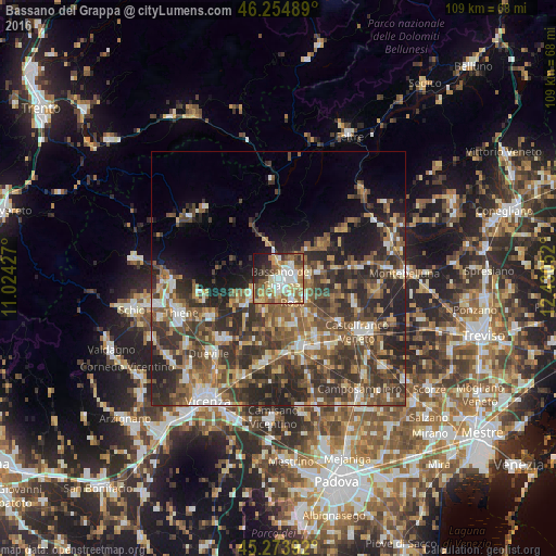
Analysis of Bassano del Grappa night lights 2016
Square area 10x10 km:
 12.06%
90-99
15.56%80-89
10.79%70-79
8.57%60-69
14.76%50-59
8.57%40-49
9.05%30-39
5.24%20-29
8.89%10-19
6.35%0-9
0.16%Square area 50x50 km:
3.1%90-99
5.17%80-89
3.28%70-79
3.94%60-69
5.32%50-59
8.08%40-49
8.85%30-39
9.07%20-29
12.29%10-19
8.3%0-9
32.59%Clear (daylight) street map image can be seen on geolist.org.
Map coordinates:
46° 15' 17.6" North, 11° 1' 27.4" East
45° 45' 59.6" North, 11° 43' 38.6" East
45° 16' 26.1" North, 12° 25' 49.9" East
Some cities around Bassano del Grappa sort by population:
• Romano d'Ezzelino
3.3 km =2.1 mi,  65°
65°
• Rosà
7.7 km =4.8 mi,  159°
159°
• San Zeno-San Giuseppe
2.9 km =1.8 mi,  111°
111°
• Marostica
5.6 km =3.5 mi,  245°
245°
• Rossano Veneto
9.2 km =5.7 mi,  140°
140°
• Belvedere
9.2 km =5.7 mi, 157°
• Galliera Veneta
13.2 km =8.2 mi,  146°
146°
• San Zenone degli Ezzelini
8.7 km =5.4 mi,  79°
79°
3182297 (p: 38,224)
Sources (retrieved 2019-11-25):
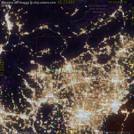
» Earth at Night: Flat Maps 2012, 2016