Bacoli night lights from space
Night Light of Bacoli (Campania) from space (Italy) Src. Average luminocity for 10x10km area is 34.0782% and for 50x50km: 26.9878%.
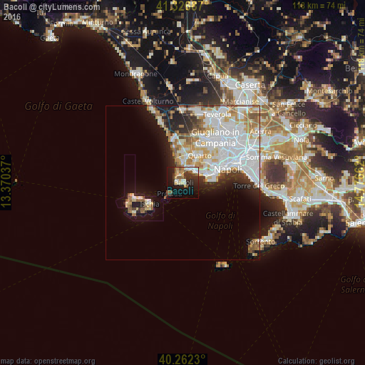
Analysis of Bacoli night lights 2016
Square area 10x10 km:
 3.57%
3.57%90-99
7.48%80-89
3.06%70-79
4.08%60-69
3.4%50-59
6.29%40-49
3.57%30-39
7.82%20-29
11.73%10-19
27.38%0-9
21.6%Square area 50x50 km:
9.09%90-99
6.92%80-89
2.55%70-79
3.01%60-69
2.64%50-59
2.34%40-49
1.31%30-39
1.8%20-29
3.77%10-19
7.34%0-9
59.23%Clear (daylight) street map image can be seen on geolist.org.
Map coordinates:
41° 19' 36.7" North, 13° 22' 13.3" East
40° 47' 48.2" North, 14° 4' 24.6" East
40° 15' 44.3" North, 14° 46' 35.8" East
Some cities around Bacoli sort by population:
• Pianura
10.9 km =6.8 mi,  50°
50°
• Pozzuoli
5.6 km =3.5 mi,  19°
19°
• Quarto
10.8 km =6.7 mi,  33°
33°
• Monterusciello
8 km =5 mi,  5°
5°
• Bagnoli
8.2 km =5.1 mi,  77°
77°
• Posillipo
10.8 km =6.7 mi, 80°
• Monte di Procida
2 km =1.2 mi,  274°
274°
• Procida
6.7 km =4.2 mi,  227°
227°
3182599 (p: 25,590)
Sources (retrieved 2019-11-25):
» Earth at Night: Flat Maps 2012, 2016