Airola night lights from space
Night Light of Airola (Campania) from space (Italy) Src. Average luminocity for 10x10km area is 42.1737% and for 50x50km: 40.9909%.
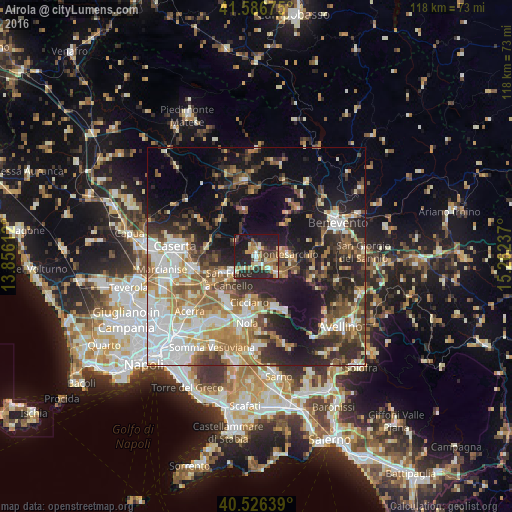
Analysis of Airola night lights 2016
Square area 10x10 km:
 2.44%
2.44%90-99
8.44%80-89
5.52%70-79
6.17%60-69
7.79%50-59
4.22%40-49
6.33%30-39
7.47%20-29
25.81%10-19
25.16%0-9
0.65%Square area 50x50 km:
7.79%90-99
8.1%80-89
4.13%70-79
4.9%60-69
6.8%50-59
5.9%40-49
5.03%30-39
6.1%20-29
11.23%10-19
18.12%0-9
21.9%Clear (daylight) street map image can be seen on geolist.org.
Map coordinates:
41° 35' 12.3" North, 13° 51' 22" East
41° 3' 31.4" North, 14° 33' 33.3" East
40° 31' 35" North, 15° 15' 44.5" East
Some cities around Airola sort by population:
• San Felice A Cancello
7.6 km =4.7 mi,  232°
232°
• Santa Maria A Vico
8.7 km =5.4 mi,  245°
245°
• Sant'Agata de'Goti
6.2 km =3.9 mi,  303°
303°
• Montesarchio
6.9 km =4.3 mi,  86°
86°
• Cervinara
6.3 km =3.9 mi,  132°
132°
• Trescine
6.5 km =4 mi, 128°
• Roccarainola
9.7 km =6 mi,  188°
188°
• Arienzo
6.2 km =3.9 mi,  235°
235°
3183378 (p: 7,305)
Sources (retrieved 2019-11-25):
» Earth at Night: Flat Maps 2012, 2016