Reykjavík night lights from space
Night Light of Reykjavík (Capital Region) from space (Iceland) Src. Average luminocity for 10x10km area is 69.1533% and for 50x50km: 7.1059%.
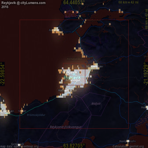
Analysis of Reykjavík night lights 2016
Square area 10x10 km:
 36.57%
90-99
17.24%80-89
4.1%70-79
0.76%60-69
0.19%50-59
0.57%40-49
2.29%30-39
14.38%20-29
18.76%10-19
5.14%0-9
0%Square area 50x50 km:
2.24%90-99
1.53%80-89
0.71%70-79
0.4%60-69
0.41%50-59
0.43%40-49
0.16%30-39
0.98%20-29
2.3%10-19
4.04%0-9
86.81%Clear (daylight) street map image can be seen on geolist.org.
Map coordinates:
64° 26' 25.9" North, 22° 35' 54.7" West
64° 8' 7.7" North, 21° 53' 43.5" West
63° 49' 37.4" North, 21° 11' 32.2" West
Some cities around Reykjavík sort by population:
• Kópavogur
2.7 km =1.7 mi,  198°
198°
• Hafnarfjörður
7.9 km =4.9 mi, 195°
• Garðabær
5.4 km =3.4 mi,  194°
194°
• Mosfellsbær
10.1 km =6.3 mi,  69°
69°
• Akranes
22.5 km =14 mi,  337°
337°
• Selfoss
49.2 km =30.6 mi,  117°
117°
• Borgarnes
44.8 km =27.8 mi,  358°
358°
• Keflavík
35.5 km =22.1 mi,  245°
245°
3413829 (p: 118,918)
Sources (retrieved 2019-11-25):
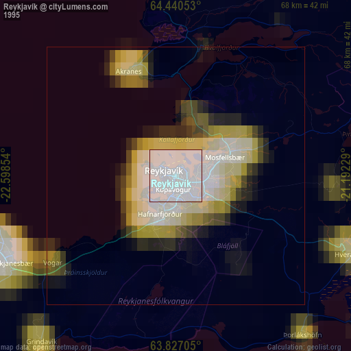
» NASA, Earths city lights 1995
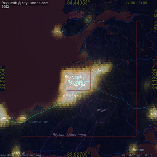
» NASA city lights 2003
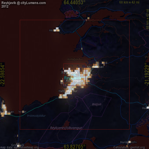
» Earth at Night: Flat Maps 2012, 2016