Tiruchchendur night lights from space
Night Light of Tiruchchendur (Tamil Nadu) from space (India) Src. Average luminocity for 10x10km area is 14.0992% and for 50x50km: 5.6948%.
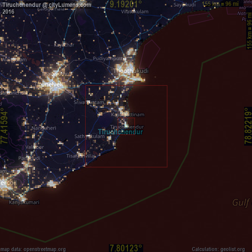
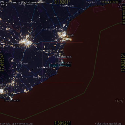
Analysis of Tiruchchendur night lights 2016
Square area 10x10 km:
 1.24%
1.24%90-99
2.07%80-89
1.65%70-79
0%60-69
2.48%50-59
0.83%40-49
4.13%30-39
2.69%20-29
2.07%10-19
12.4%0-9
70.45%Square area 50x50 km:
0.2%90-99
0.65%80-89
0.66%70-79
0.37%60-69
0.61%50-59
0.72%40-49
1.38%30-39
1.39%20-29
1.23%10-19
5.82%0-9
86.96%Clear (daylight) street map image can be seen on geolist.org.
Map coordinates:
9° 11' 31.2" North, 77° 24' 57.4" East
8° 29' 50.1" North, 78° 7' 8.6" East
7° 48' 4.4" North, 78° 49' 19.9" East
Some cities around Tiruchchendur sort by population:
• Thoothukudi
30.1 km =18.7 mi,  3°
3°
• Kayalpattinam
8.2 km =5.1 mi, 0°
• Arumuganeri
8.5 km =5.3 mi,  338°
338°
• Udangudi
12.4 km =7.7 mi,  232°
232°
• Srivaikuntam
27 km =16.8 mi,  302°
302°
• Sathankulam
23.4 km =14.5 mi,  254°
254°
• Eral
17.8 km =11.1 mi,  323°
323°
• Alwa Tirunagari
23.1 km =14.4 mi, 301°
1254390 (p: 29,872)
Sources (retrieved 2019-11-25):
» Earth at Night: Flat Maps 2012, 2016