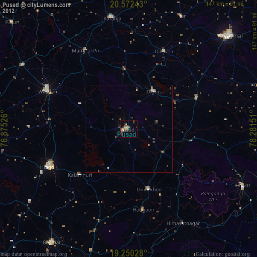
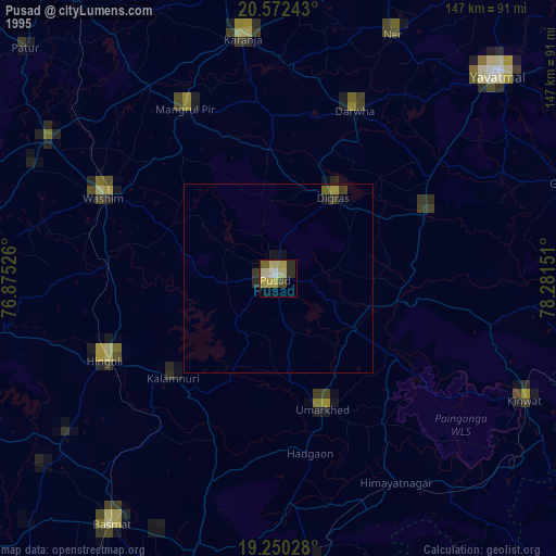
Pusad night lights from space
Night Light of Pusad (Maharashtra) from space (India) Src. Average luminocity for 10x10km area is 41.0065% and for 50x50km: 6.3601%.


Analysis of Pusad night lights 2016
Square area 10x10 km:
 5.84%
5.84%90-99
7.36%80-89
3.9%70-79
3.03%60-69
6.28%50-59
5.41%40-49
7.79%30-39
10.82%20-29
14.72%10-19
31.39%0-9
3.46%Square area 50x50 km:
0.34%90-99
0.52%80-89
0.43%70-79
0.56%60-69
1.02%50-59
1.25%40-49
1.39%30-39
1.97%20-29
1.97%10-19
3.98%0-9
86.58%Clear (daylight) street map image can be seen on geolist.org.
Map coordinates:
20° 34' 20.7" North, 76° 52' 30.9" East
19° 54' 45.9" North, 77° 34' 42.2" East
19° 15' 1" North, 78° 16' 53.4" East
Some cities around Pusad sort by population:
• Hingoli
50.6 km =31.4 mi,  244°
244°
• Digras
25.8 km =16 mi,  34°
34°
• Umarkhed
36.5 km =22.7 mi,  161°
161°
• Mangrūl Pīr
51 km =31.7 mi,  331°
331°
• Hadgāon
47.1 km =29.3 mi,  169°
169°
• Dārwha
48.6 km =30.2 mi,  24°
24°
• Kalamnūri
38.5 km =23.9 mi,  226°
226°
• Anshing
31 km =19.3 mi,  297°
297°
1259154 (p: 71,588)
Sources (retrieved 2019-11-25):
» NASA, Earths city lights 1995
» NASA city lights 2003
» Earth at Night: Flat Maps 2012, 2016