Karmāla night lights from space
Night Light of Karmāla (Maharashtra) from space (India) Src. Average luminocity for 10x10km area is 10.6322% and for 50x50km: 7.4028%.
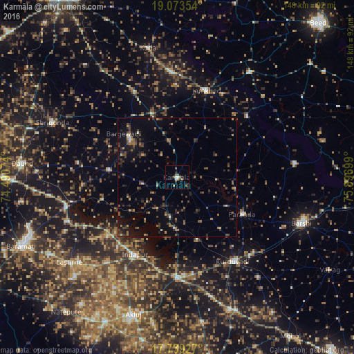
Analysis of Karmāla night lights 2016
Square area 10x10 km:
 1.03%
1.03%90-99
1.45%80-89
0%70-79
1.65%60-69
2.48%50-59
2.89%40-49
1.24%30-39
0.21%20-29
3.1%10-19
0%0-9
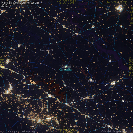
85.95%Square area 50x50 km:
0.12%90-99
0.37%80-89
0.47%70-79
0.63%60-69
1.19%50-59
1.68%40-49
1.74%30-39
2.09%20-29
2.66%10-19
4.3%0-9
84.74%Clear (daylight) street map image can be seen on geolist.org.
Map coordinates:
19° 4' 24.7" North, 74° 29' 26.7" East
18° 24' 27.7" North, 75° 11' 37.9" East
17° 44' 21.4" North, 75° 53' 49.2" East
Some cities around Karmāla sort by population:
• Bārsi
56.1 km =34.9 mi,  110°
110°
• Bārāmati
71 km =44.1 mi,  246°
246°
• Daund
64.7 km =40.2 mi,  275°
275°
• Shrīgonda
57.1 km =35.5 mi,  293°
293°
• Kurduvādi
42.1 km =26.2 mi,  146°
146°
• Bhūm
49.4 km =30.7 mi,  83°
83°
• Kalas
50 km =31.1 mi,  238°
238°
• Bhigvan
46.6 km =29 mi,  255°
255°
1267716 (p: 22,809)
Sources (retrieved 2019-11-25):
» Earth at Night: Flat Maps 2012, 2016