Melati night lights from space
Night Light of Melati (Yogyakarta) from space (Indonesia) Src. Average luminocity for 10x10km area is 68.2955% and for 50x50km: 20.0843%.
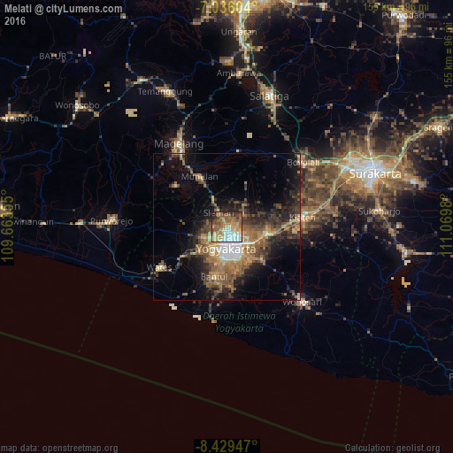
Analysis of Melati night lights 2016
Square area 10x10 km:
 14.26%
90-99
10.54%80-89
8.47%70-79
14.26%60-69
13.84%50-59
19.21%40-49
6.2%30-39
6.82%20-29
4.34%10-19
2.07%0-9
0%Square area 50x50 km:
1.89%90-99
1.75%80-89
1.79%70-79
3%60-69
4.6%50-59
4.87%40-49
3.97%30-39
4.02%20-29
6.52%10-19
9.3%0-9
58.29%Clear (daylight) street map image can be seen on geolist.org.
Map coordinates:
7° 2' 9.7" South, 109° 39' 48.8" East
7° 43' 60" South, 110° 22' 0" East
8° 25' 46.1" South, 111° 4' 11.3" East
Some cities around Melati sort by population:
• Yogyakarta
7.6 km =4.7 mi,  181°
181°
• Depok
7.9 km =4.9 mi,  114°
114°
• Kasihan
11.2 km =7 mi,  201°
201°
• Sewon
15.9 km =9.9 mi, 183°
• Gamping Lor
8.2 km =5.1 mi,  212°
212°
• Godean
9 km =5.6 mi,  243°
243°
• Sleman
2.3 km =1.4 mi,  328°
328°
• Candi Prambanan
14.2 km =8.8 mi,  97°
97°
1635660 (p: 67,090)
Sources (retrieved 2019-11-25):
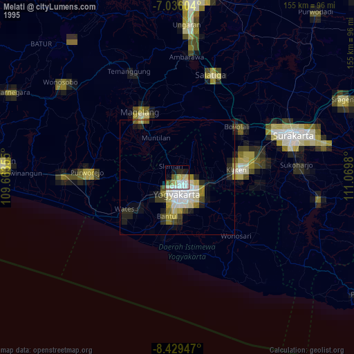
» NASA, Earths city lights 1995
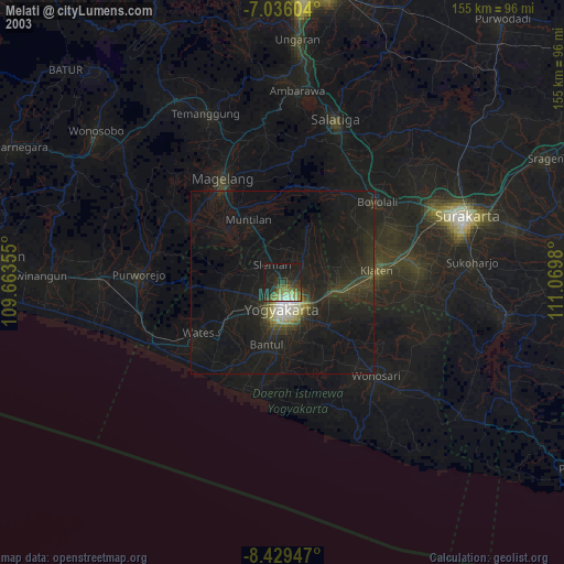
» NASA city lights 2003
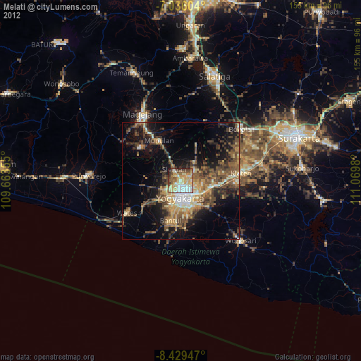
» Earth at Night: Flat Maps 2012, 2016