Izsák night lights from space
Night Light of Izsák (Bács-Kiskun) from space (Hungary) Src. Average luminocity for 10x10km area is 1.2693% and for 50x50km: 1.3631%.
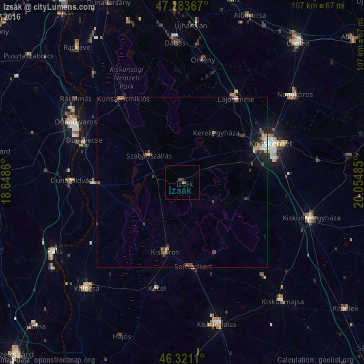
Analysis of Izsák night lights 2016
Square area 10x10 km:
 0%
0%90-99
0%80-89
0%70-79
0%60-69
0%50-59
1.19%40-49
0%30-39
0.45%20-29
0.89%10-19
0.45%0-9
97.02%Square area 50x50 km:
0.09%90-99
0.15%80-89
0.17%70-79
0.16%60-69
0.08%50-59
0.24%40-49
0.32%30-39
0.3%20-29
0.53%10-19
1.09%0-9
96.87%Clear (daylight) street map image can be seen on geolist.org.
Map coordinates:
47° 17' 1.2" North, 18° 38' 55" East
46° 48' 16.3" North, 19° 21' 6.2" East
46° 19' 16" North, 20° 3' 17.5" East
Some cities around Izsák sort by population:
• Kecskemét
28.2 km =17.5 mi,  66°
66°
• Kiskőrös
21 km =13 mi,  193°
193°
• Lajosmizse
28.9 km =18 mi,  33°
33°
• Kunszentmiklós
30.1 km =18.7 mi,  325°
325°
• Soltvadkert
25.3 km =15.7 mi,  172°
172°
• Solt
26.7 km =16.6 mi,  269°
269°
• Szabadszállás
12.6 km =7.8 mi,  309°
309°
• Kerekegyháza
17.6 km =10.9 mi, 33°
3051016 (p: 6,117)
Sources (retrieved 2019-11-25):
» Earth at Night: Flat Maps 2012, 2016