Tigwav night lights from space
Night Light of Tigwav (Ouest) from space (Haiti) Src. Average luminocity for 10x10km area is 1.2583% and for 50x50km: 0.0988%.
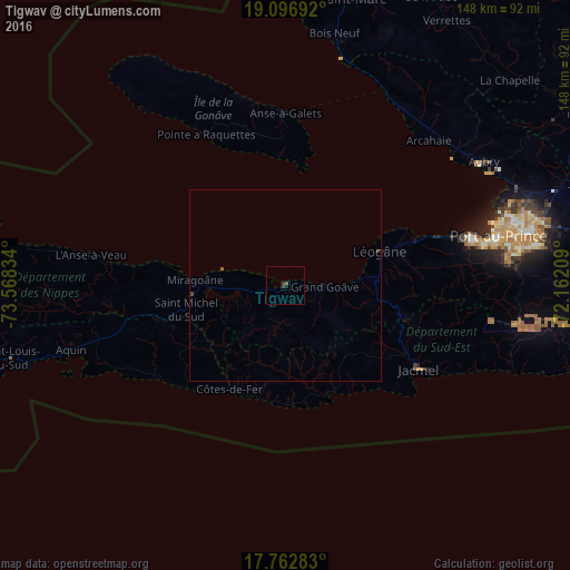
Analysis of Tigwav night lights 2016
Square area 10x10 km:
 0%
0%90-99
0%80-89
0%70-79
0%60-69
0%50-59
0.83%40-49
0%30-39
1.65%20-29
0%10-19
0.83%0-9
96.69%Square area 50x50 km:
0%90-99
0%80-89
0%70-79
0%60-69
0%50-59
0.06%40-49
0.06%30-39
0.07%20-29
0%10-19
0.04%0-9
99.76%Clear (daylight) street map image can be seen on geolist.org.
Map coordinates:
19° 5' 48.9" North, 73° 34' 6" West
18° 25' 52.2" North, 72° 51' 54.8" West
17° 45' 46.2" North, 72° 9' 43.5" West
Some cities around Tigwav sort by population:
• Port-au-Prince
56.9 km =35.4 mi,  77°
77°
• Carrefour
50.6 km =31.4 mi, 76°
• Jacmel
41.1 km =25.5 mi,  122°
122°
• Léogâne
26 km =16.2 mi,  70°
70°
• Miragoâne
23.7 km =14.7 mi,  273°
273°
• Grangwav
10.1 km =6.3 mi,  93°
93°
• Gressier
37.7 km =23.4 mi, 71°
• Anse à Galets
44.8 km =27.8 mi,  359°
359°
3718962 (p: 117,504)
Sources (retrieved 2019-11-25):
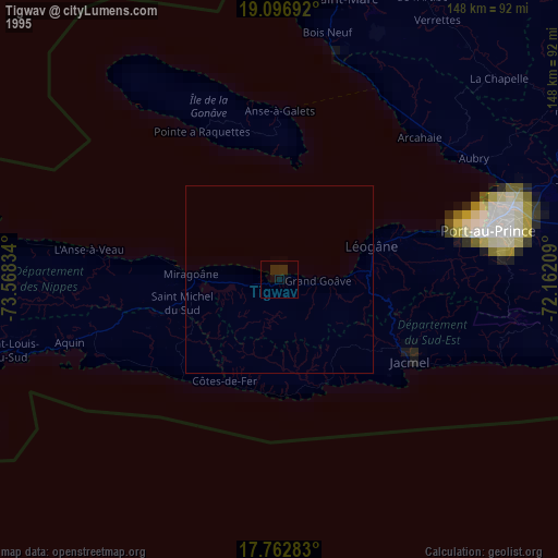
» NASA, Earths city lights 1995
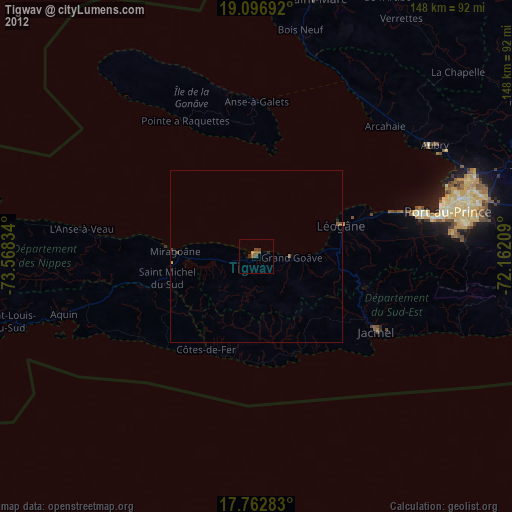
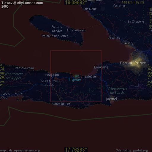
» NASA city lights 2003
» Earth at Night: Flat Maps 2012, 2016