Zadar night lights from space
Night Light of Zadar (Zadarska) from space (Croatia) Src. Average luminocity for 10x10km area is 43.5061% and for 50x50km: 6.4257%.
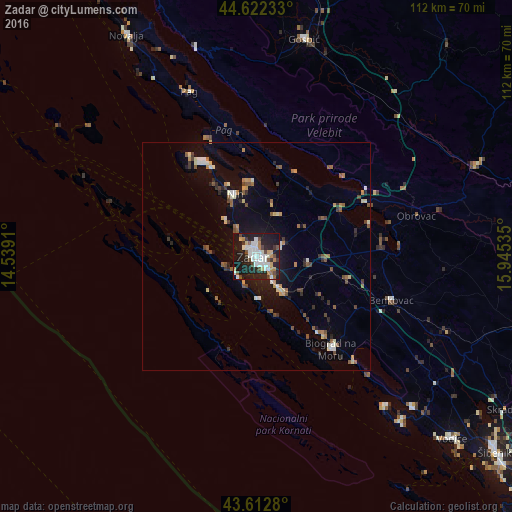
Analysis of Zadar night lights 2016
Square area 10x10 km:
 11.52%
90-99
9.24%80-89
3.48%70-79
3.18%60-69
3.79%50-59
3.03%40-49
6.52%30-39
3.94%20-29
16.82%10-19
36.52%0-9
1.97%Square area 50x50 km:
0.67%90-99
1.03%80-89
0.61%70-79
0.63%60-69
0.7%50-59
0.96%40-49
1.01%30-39
0.69%20-29
1.51%10-19
4.73%0-9
87.47%Clear (daylight) street map image can be seen on geolist.org.
Map coordinates:
44° 37' 20.4" North, 14° 32' 20.8" East
44° 7' 11" North, 15° 14' 32" East
43° 36' 46.1" North, 15° 56' 43.3" East
Some cities around Zadar sort by population:
• Bihać, BA
92.2 km =57.3 mi,  32°
32°
• Šibenik
67.5 km =41.9 mi,  129°
129°
• Knin
76.7 km =47.7 mi,  96°
96°
• Vodice
58.9 km =36.6 mi, 132°
• Gospić
48.6 km =30.2 mi,  12°
12°
• Bosansko Grahovo, BA
89.7 km =55.7 mi,  85°
85°
• Senj
100.3 km =62.3 mi,  344°
344°
• Biograd na Moru
25.8 km =16 mi,  139°
139°
3186952 (p: 71,258)
Sources (retrieved 2019-11-25):
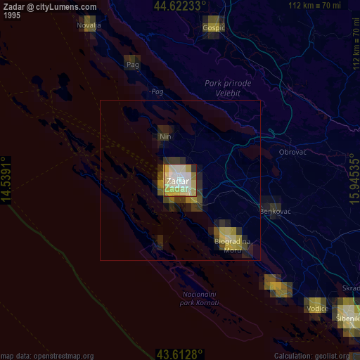
» NASA, Earths city lights 1995
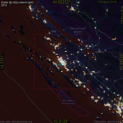
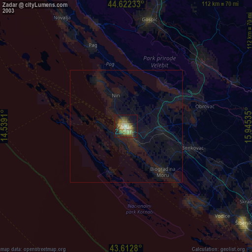
» NASA city lights 2003
» Earth at Night: Flat Maps 2012, 2016