Vrontádos night lights from space
Night Light of Vrontádos (North Aegean) from space (Greece) Src. Average luminocity for 10x10km area is 13.586% and for 50x50km: 5.8275%.
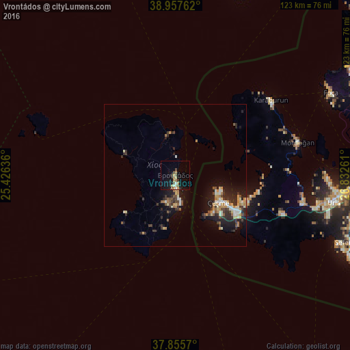
Analysis of Vrontádos night lights 2016
Square area 10x10 km:
 0%
0%90-99
1.95%80-89
1.62%70-79
3.25%60-69
2.27%50-59
1.14%40-49
2.76%30-39
1.3%20-29
0.16%10-19
13.31%0-9
72.24%Square area 50x50 km:
0.3%90-99
1.13%80-89
0.67%70-79
0.97%60-69
0.7%50-59
0.53%40-49
0.79%30-39
1.13%20-29
1.97%10-19
4.52%0-9
87.3%Clear (daylight) street map image can be seen on geolist.org.
Map coordinates:
38° 57' 27.4" North, 25° 25' 34.9" East
38° 24' 31.5" North, 26° 7' 46.1" East
37° 51' 20.5" North, 26° 49' 57.4" East
Some cities around Vrontádos sort by population:
• Menemen, TR
84.7 km =52.6 mi,  74°
74°
• Urla, TR
56.1 km =34.9 mi,  99°
99°
• Aliağa, TR
85.1 km =52.9 mi,  59°
59°
• Chios
4.5 km =2.8 mi,  171°
171°
• Çeşme, TR
17.9 km =11.1 mi,  120°
120°
• Seferihisar, TR
66.2 km =41.1 mi,  110°
110°
• Foça, TR
61.8 km =38.4 mi, 61°
• Néon Karlovásion
85.1 km =52.9 mi,  143°
143°
251606 (p: 5,323)
Sources (retrieved 2019-11-25):
» Earth at Night: Flat Maps 2012, 2016