Kalamata night lights from space
Night Light of Kalamata (Peloponnese) from space (Greece) Src. Average luminocity for 10x10km area is 41.7925% and for 50x50km: 5.6574%.
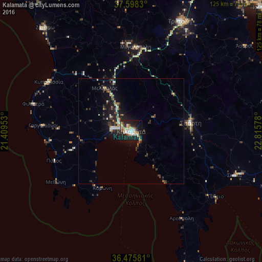
Analysis of Kalamata night lights 2016
Square area 10x10 km:
 6.97%
6.97%90-99
7.99%80-89
6.46%70-79
8.16%60-69
4.59%50-59
1.7%40-49
2.72%30-39
4.42%20-29
14.46%10-19
35.71%0-9
6.8%Square area 50x50 km:
0.32%90-99
1.03%80-89
0.63%70-79
0.66%60-69
0.65%50-59
0.42%40-49
0.76%30-39
1.56%20-29
1.87%10-19
5.16%0-9
86.95%Clear (daylight) street map image can be seen on geolist.org.
Map coordinates:
37° 35' 53.9" North, 21° 24' 34.3" East
37° 2' 20.9" North, 22° 6' 45.5" East
36° 28' 32.9" North, 22° 48' 56.8" East
Some cities around Kalamata sort by population:
• Trípoli
57.3 km =35.6 mi,  24°
24°
• Spárti
28.4 km =17.6 mi,  82°
82°
• Filiatrá
48.5 km =30.1 mi,  285°
285°
• Messíni
9.4 km =5.8 mi,  278°
278°
• Gargaliánoi
42.2 km =26.2 mi,  273°
273°
• Zacháro
64.2 km =39.9 mi,  320°
320°
• Megalópoli
40.3 km =25 mi,  3°
3°
• Kyparissía
45.5 km =28.3 mi,  301°
301°
261604 (p: 54,100)
Sources (retrieved 2019-11-25):
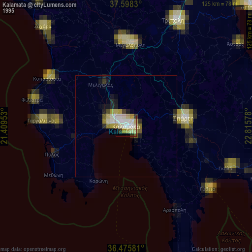
» NASA, Earths city lights 1995
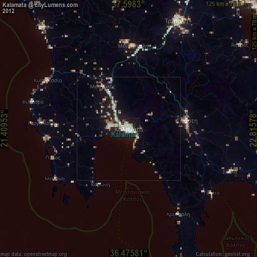
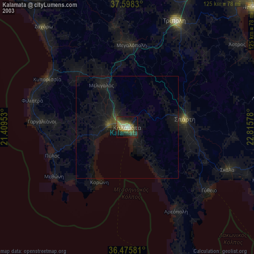
» NASA city lights 2003
» Earth at Night: Flat Maps 2012, 2016