Ágios Nikólaos night lights from space
Night Light of Ágios Nikólaos (Crete) from space (Greece) Src. Average luminocity for 10x10km area is 16.1748% and for 50x50km: 3.1268%.
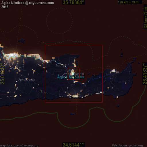
Analysis of Ágios Nikólaos night lights 2016
Square area 10x10 km:
 1.4%
1.4%90-99
0.7%80-89
2.62%70-79
5.07%60-69
0%50-59
0.7%40-49
2.62%30-39
3.67%20-29
1.05%10-19
10.14%0-9
72.03%Square area 50x50 km:
0.11%90-99
0.39%80-89
0.54%70-79
0.53%60-69
0.19%50-59
0.34%40-49
0.53%30-39
0.82%20-29
0.46%10-19
0.93%0-9
95.16%Clear (daylight) street map image can be seen on geolist.org.
Map coordinates:
35° 45' 49.1" North, 25° 0' 43.6" East
35° 11' 27.8" North, 25° 42' 54.9" East
34° 36' 51.9" North, 26° 25' 6.1" East
Some cities around Ágios Nikólaos sort by population:
• Irákleion
54.1 km =33.6 mi,  286°
286°
• Rethymno
113.6 km =70.6 mi,  279°
279°
• Gázi
60.7 km =37.7 mi, 284°
• Ierápetra
20.1 km =12.5 mi,  172°
172°
• Néa Alikarnassós
53.1 km =33 mi, 288°
• Sitia
35.4 km =22 mi,  86°
86°
• Moíres
78.1 km =48.5 mi,  258°
258°
• Tympáki
87.1 km =54.1 mi, 261°
263824 (p: 11,421)
Sources (retrieved 2019-11-25):
» Earth at Night: Flat Maps 2012, 2016