Saint-Nazaire night lights from space
Night Light of Saint-Nazaire (Pays de la Loire) from space (France) Src. Average luminocity for 10x10km area is 58.4196% and for 50x50km: 8.6091%.
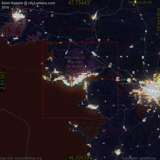
Analysis of Saint-Nazaire night lights 2016
Square area 10x10 km:
 15.63%
90-99
15.03%80-89
8.93%70-79
4.46%60-69
1.93%50-59
2.53%40-49
8.18%30-39
9.38%20-29
27.98%10-19
5.95%0-9
0%Square area 50x50 km:
1.4%90-99
1.6%80-89
0.77%70-79
0.71%60-69
0.54%50-59
0.85%40-49
1.32%30-39
1.16%20-29
2.79%10-19
7.35%0-9
81.51%Clear (daylight) street map image can be seen on geolist.org.
Map coordinates:
47° 45' 15.9" North, 2° 54' 47" West
47° 16' 46.4" North, 2° 12' 35.7" West
46° 48' 1.4" North, 1° 30' 24.5" West
Some cities around Saint-Nazaire sort by population:
• La Baule-Escoublac
11.7 km =7.3 mi,  276°
276°
• Guérande
17.4 km =10.8 mi,  288°
288°
• Pornichet
9.8 km =6.1 mi,  261°
261°
• Pontchâteau
19.8 km =12.3 mi,  27°
27°
• Trignac
4.6 km =2.9 mi,  20°
20°
• Montoir-de-Bretagne
7.2 km =4.5 mi,  38°
38°
• Donges
11 km =6.8 mi,  67°
67°
• Le Pouliguen
16.5 km =10.3 mi,  266°
266°
2977921 (p: 67,054)
Sources (retrieved 2019-11-25):
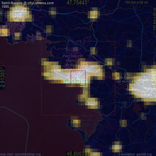
» NASA, Earths city lights 1995
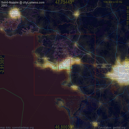
» NASA city lights 2003
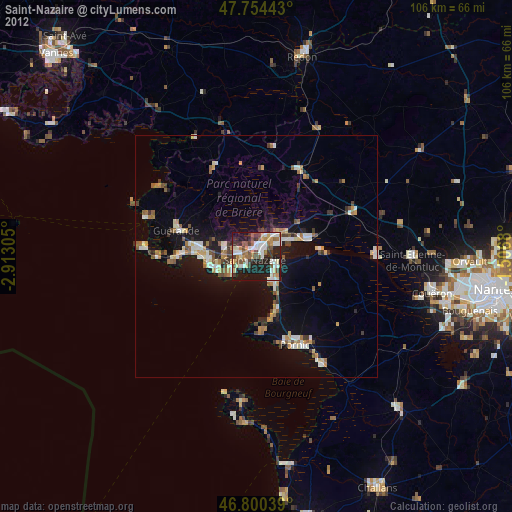
» Earth at Night: Flat Maps 2012, 2016