Pontchâteau night lights from space
Night Light of Pontchâteau (Pays de la Loire) from space (France) Src. Average luminocity for 10x10km area is 6.6193% and for 50x50km: 7.3678%.
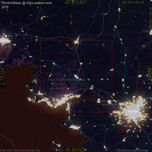
Analysis of Pontchâteau night lights 2016
Square area 10x10 km:
 1.14%
1.14%90-99
1.7%80-89
0.57%70-79
0.28%60-69
0.85%50-59
0.57%40-49
0.57%30-39
0.57%20-29
1.42%10-19
0.28%0-9
92.05%Square area 50x50 km:
1.28%90-99
1.46%80-89
0.71%70-79
0.65%60-69
0.43%50-59
0.64%40-49
1.18%30-39
0.89%20-29
2.54%10-19
5.63%0-9
84.58%Clear (daylight) street map image can be seen on geolist.org.
Map coordinates:
47° 54' 41.1" North, 2° 47' 35.7" West
47° 26' 16.7" North, 2° 5' 24.4" West
46° 57' 36.8" North, 1° 23' 13.2" West
Some cities around Pontchâteau sort by population:
• Saint-Nazaire
19.8 km =12.3 mi,  207°
207°
• Saint-Brevin-les-Pins
21.7 km =13.5 mi,  195°
195°
• Redon
23.7 km =14.7 mi,  0°
0°
• Blain
25 km =15.5 mi,  80°
80°
• Trignac
15.3 km =9.5 mi, 209°
• Savenay
14.1 km =8.8 mi,  127°
127°
• Montoir-de-Bretagne
12.8 km =8 mi, 200°
• Donges
13.4 km =8.3 mi,  175°
175°
2986271 (p: 8,474)
Sources (retrieved 2019-11-25):
» Earth at Night: Flat Maps 2012, 2016