Saint-Lambert night lights from space
Night Light of Saint-Lambert (Provence-Alpes-Côte d'Azur) from space (France) Src. Average luminocity for 10x10km area is 65.2561% and for 50x50km: 27.6124%.
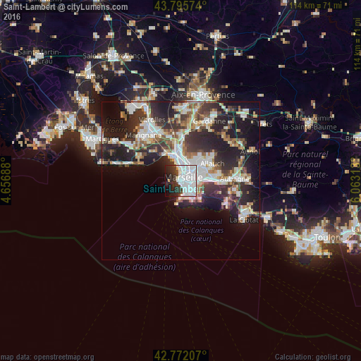
Analysis of Saint-Lambert night lights 2016
Square area 10x10 km:
 41.52%
90-99
12.73%80-89
0.76%70-79
1.06%60-69
0%50-59
1.06%40-49
2.58%30-39
8.18%20-29
12.58%10-19
13.18%0-9
6.36%Square area 50x50 km:
6.26%90-99
6.01%80-89
2.77%70-79
2.06%60-69
2.7%50-59
2.99%40-49
3.09%30-39
5.36%20-29
10.26%10-19
14.2%0-9
44.29%Clear (daylight) street map image can be seen on geolist.org.
Map coordinates:
43° 47' 44.7" North, 4° 39' 24.8" East
43° 17' 9.8" North, 5° 21' 36" East
42° 46' 19.5" North, 6° 3' 47.3" East
Some cities around Saint-Lambert sort by population:
• Marseille 06
1.6 km =1 mi,  83°
83°
• Marseille 07
0.4 km =0.2 mi,  177°
177°
• Marseille 02
1.4 km =0.9 mi,  35°
35°
• Marseille Vauban
1.3 km =0.8 mi,  100°
100°
• Marseille Saint-Victor
0.8 km =0.5 mi,  60°
60°
• Le Pharo
0.6 km =0.4 mi,  346°
346°
• Palais de Justice
1.3 km =0.8 mi,  87°
87°
• Marseille Endoume
0.8 km =0.5 mi,  244°
244°
11919757 (p: 9,456)
Sources (retrieved 2019-11-25):
» Earth at Night: Flat Maps 2012, 2016