Pornic night lights from space
Night Light of Pornic (Pays de la Loire) from space (France) Src. Average luminocity for 10x10km area is 19.9418% and for 50x50km: 7.7368%.
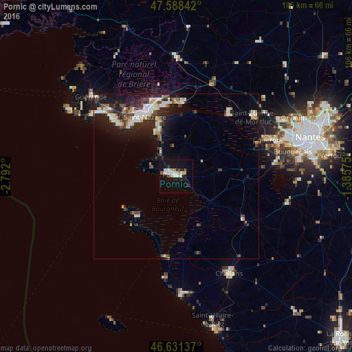
Analysis of Pornic night lights 2016
Square area 10x10 km:
 3.84%
3.84%90-99
4.12%80-89
2.13%70-79
1.85%60-69
1.7%50-59
1.42%40-49
0.85%30-39
1.42%20-29
2.84%10-19
22.02%0-9
57.81%Square area 50x50 km:
1.35%90-99
1.44%80-89
0.79%70-79
0.66%60-69
0.49%50-59
0.77%40-49
1.24%30-39
0.96%20-29
2.83%10-19
5.67%0-9
83.82%Clear (daylight) street map image can be seen on geolist.org.
Map coordinates:
47° 35' 18.3" North, 2° 47' 31.2" West
47° 6' 43.4" North, 2° 5' 20" West
46° 37' 52.9" North, 1° 23' 8.7" West
Some cities around Pornic sort by population:
• Saint-Nazaire
20.7 km =12.9 mi,  333°
333°
• La Baule-Escoublac
28.9 km =18 mi,  313°
313°
• Saint-Brevin-les-Pins
16.4 km =10.2 mi,  339°
339°
• Trignac
24.1 km =15 mi, 341°
• Saint-Étienne-de-Montluc
29.6 km =18.4 mi,  51°
51°
• Montoir-de-Bretagne
24.7 km =15.3 mi,  349°
349°
• Donges
22.9 km =14.2 mi,  2°
2°
• Machecoul
24 km =14.9 mi,  123°
123°
2986060 (p: 12,897)
Sources (retrieved 2019-11-25):
» Earth at Night: Flat Maps 2012, 2016