Périer night lights from space
Night Light of Périer (Provence-Alpes-Côte d'Azur) from space (France) Src. Average luminocity for 10x10km area is 73.8955% and for 50x50km: 26.8674%.
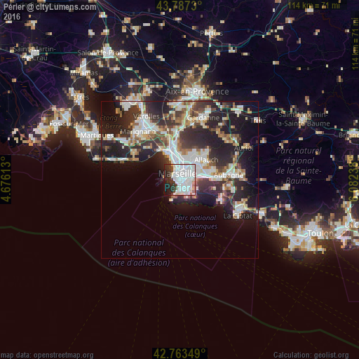
Analysis of Périer night lights 2016
Square area 10x10 km:
 41.97%
90-99
18.18%80-89
3.64%70-79
1.36%60-69
1.97%50-59
1.97%40-49
2.42%30-39
7.88%20-29
10.45%10-19
8.94%0-9
1.21%Square area 50x50 km:
6.13%90-99
5.82%80-89
2.69%70-79
1.96%60-69
2.68%50-59
2.83%40-49
3.05%30-39
5.15%20-29
9.88%10-19
13.78%0-9
46.01%Clear (daylight) street map image can be seen on geolist.org.
Map coordinates:
43° 47' 14.3" North, 4° 40' 34.1" East
43° 16' 39.2" North, 5° 22' 45.3" East
42° 45' 48.6" North, 6° 4' 56.6" East
Some cities around Périer sort by population:
• Marseille 08
0.8 km =0.5 mi,  162°
162°
• Marseille 06
1.1 km =0.7 mi,  359°
359°
• Saint-Giniez
1 km =0.6 mi,  150°
150°
• Rouet
1 km =0.6 mi,  86°
86°
• Marseille Vauban
0.8 km =0.5 mi,  336°
336°
• Lodi
1.3 km =0.8 mi,  37°
37°
• Castellane
1 km =0.6 mi,  17°
17°
• Palais de Justice
1 km =0.6 mi,  345°
345°
11919759 (p: 12,897)
Sources (retrieved 2019-11-25):
» Earth at Night: Flat Maps 2012, 2016