Gravelines night lights from space
Night Light of Gravelines (Hauts-de-France) from space (France) Src. Average luminocity for 10x10km area is 34.9318% and for 50x50km: 11.6555%.
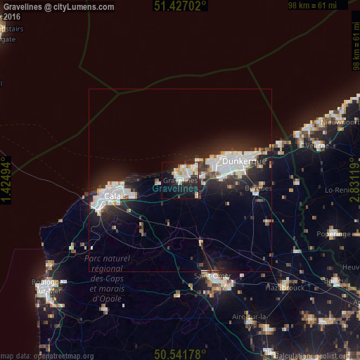
Analysis of Gravelines night lights 2016
Square area 10x10 km:
 7.75%
7.75%90-99
10.29%80-89
4.28%70-79
2.94%60-69
2.01%50-59
1.47%40-49
0.94%30-39
1.47%20-29
12.43%10-19
26.87%0-9
29.55%Square area 50x50 km:
2.98%90-99
2.85%80-89
0.82%70-79
0.6%60-69
0.57%50-59
0.6%40-49
0.88%30-39
1.5%20-29
4.82%10-19
8.73%0-9
75.65%Clear (daylight) street map image can be seen on geolist.org.
Map coordinates:
51° 25' 37.3" North, 1° 25' 29.8" East
50° 59' 11.4" North, 2° 7' 41.1" East
50° 32' 30.4" North, 2° 49' 52.3" East
Some cities around Gravelines sort by population:
• Saint-Pol-sur-Mer
15.6 km =9.7 mi,  71°
71°
• Grande-Synthe
12.4 km =7.7 mi,  75°
75°
• Marck
13.6 km =8.5 mi,  252°
252°
• Cappelle-la-Grande
16.2 km =10.1 mi, 84°
• Bourbourg
6.4 km =4 mi,  132°
132°
• Loon-Plage
6.4 km =4 mi, 79°
• Grand-Fort-Philippe
2 km =1.2 mi,  315°
315°
• Oye-Plage
6.1 km =3.8 mi,  260°
260°
3014816 (p: 13,137)
Sources (retrieved 2019-11-25):
» Earth at Night: Flat Maps 2012, 2016