Concarneau night lights from space
Night Light of Concarneau (Brittany) from space (France) Src. Average luminocity for 10x10km area is 14.7869% and for 50x50km: 3.3792%.
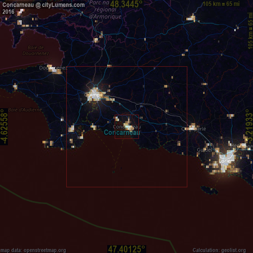
Analysis of Concarneau night lights 2016
Square area 10x10 km:
 0.99%
0.99%90-99
2.56%80-89
1.7%70-79
3.55%60-69
1.28%50-59
1.85%40-49
2.84%30-39
1.7%20-29
0%10-19
2.7%0-9
80.82%Square area 50x50 km:
0.33%90-99
0.6%80-89
0.39%70-79
0.38%60-69
0.35%50-59
0.43%40-49
0.43%30-39
0.43%20-29
0.48%10-19
2.25%0-9
93.91%Clear (daylight) street map image can be seen on geolist.org.
Map coordinates:
48° 20' 40.2" North, 4° 37' 32.1" West
47° 52' 30.1" North, 3° 55' 20.8" West
47° 24' 4.5" North, 3° 13' 9.6" West
Some cities around Concarneau sort by population:
• Quimper
19.2 km =11.9 mi,  316°
316°
• Fouesnant
7.1 km =4.4 mi,  285°
285°
• Ergué-Gabéric
15.3 km =9.5 mi,  331°
331°
• Moëlan-sur-Mer
22.9 km =14.2 mi,  107°
107°
• Pont-l’Abbé
22 km =13.7 mi,  267°
267°
• Rosporden
12.2 km =7.6 mi,  33°
33°
• Trégunc
6.1 km =3.8 mi,  117°
117°
• Bannalec
17.9 km =11.1 mi,  69°
69°
3024035 (p: 21,397)
Sources (retrieved 2019-11-25):
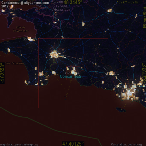
» Earth at Night: Flat Maps 2012, 2016