Tampere night lights from space
Night Light of Tampere (Pirkanmaa) from space (Finland) Src. Average luminocity for 10x10km area is 70.8768% and for 50x50km: 13.6698%.
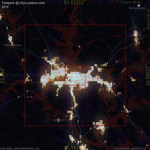
Analysis of Tampere night lights 2016
Square area 10x10 km:
 40.48%
90-99
14.6%80-89
2.48%70-79
1.86%60-69
2.28%50-59
0.41%40-49
4.45%30-39
12.32%20-29
16.25%10-19
4.87%0-9
0%Square area 50x50 km:
4.12%90-99
2.82%80-89
0.88%70-79
0.88%60-69
0.97%50-59
0.9%40-49
1.18%30-39
2.12%20-29
4.69%10-19
8.54%0-9
72.91%Clear (daylight) street map image can be seen on geolist.org.
Map coordinates:
61° 49' 58.2" North, 23° 5' 2.4" East
61° 29' 56.8" North, 23° 47' 13.6" East
61° 9' 42.4" North, 24° 29' 24.9" East
Some cities around Tampere sort by population:
• Nokia
15.7 km =9.8 mi,  256°
256°
• Kangasala
15.8 km =9.8 mi,  104°
104°
• Ylöjärvi
12 km =7.5 mi,  302°
302°
• Valkeakoski
29.2 km =18.1 mi,  153°
153°
• Lempäälä
20.4 km =12.7 mi,  185°
185°
• Pirkkala
9.2 km =5.7 mi,  242°
242°
• Hämeenkyrö
35 km =21.7 mi, 296°
• Viiala
32.1 km =19.9 mi,  181°
181°
634963 (p: 202,687)
Sources (retrieved 2019-11-25):
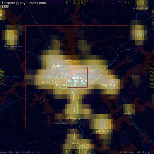
» NASA, Earths city lights 1995
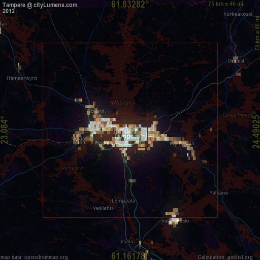
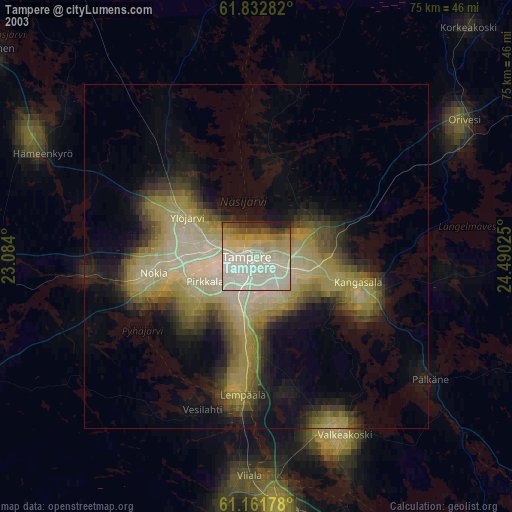
» NASA city lights 2003
» Earth at Night: Flat Maps 2012, 2016