Vigo night lights from space
Night Light of Vigo (Galicia) from space (Spain) Src. Average luminocity for 10x10km area is 78.8894% and for 50x50km: 28.5312%.
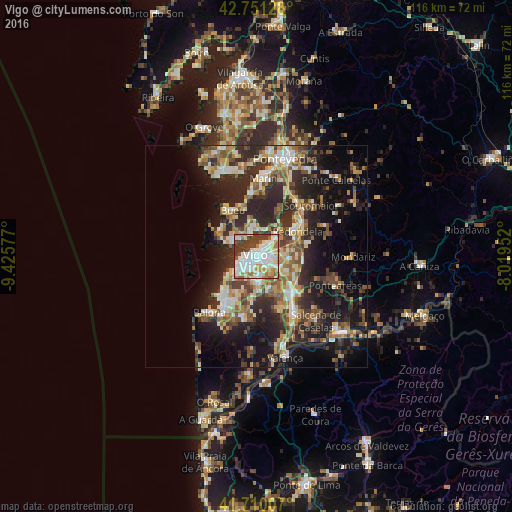
Analysis of Vigo night lights 2016
Square area 10x10 km:
 26.06%
90-99
26.36%80-89
8.03%70-79
6.82%60-69
8.79%50-59
2.88%40-49
7.58%30-39
13.48%20-29
0%10-19
0%0-9
0%Square area 50x50 km:
3.02%90-99
5.62%80-89
3.52%70-79
3.55%60-69
4.13%50-59
4.39%40-49
4.13%30-39
5.3%20-29
11.83%10-19
14.97%0-9
39.54%Clear (daylight) street map image can be seen on geolist.org.
Map coordinates:
42° 45' 4.6" North, 9° 25' 32.8" West
42° 13' 58.2" North, 8° 43' 21.5" West
41° 42' 36.3" North, 8° 1' 10.3" West
Some cities around Vigo sort by population:
• Redondela
10.9 km =6.8 mi,  58°
58°
• Cangas do Morrazo
6.2 km =3.9 mi,  304°
304°
• Moaña
5.2 km =3.2 mi,  344°
344°
• Nigrán
12.3 km =7.6 mi,  214°
214°
• Porriño
11.6 km =7.2 mi,  133°
133°
• Gondomar
13.7 km =8.5 mi,  189°
189°
• Bueu
11.4 km =7.1 mi,  333°
333°
• Baiona
16.6 km =10.3 mi,  219°
219°
3105976 (p: 297,332)
Sources (retrieved 2019-11-25):
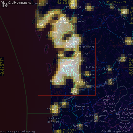
» NASA, Earths city lights 1995
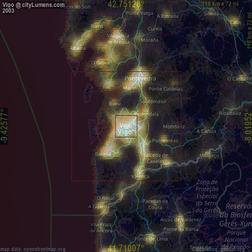
» NASA city lights 2003
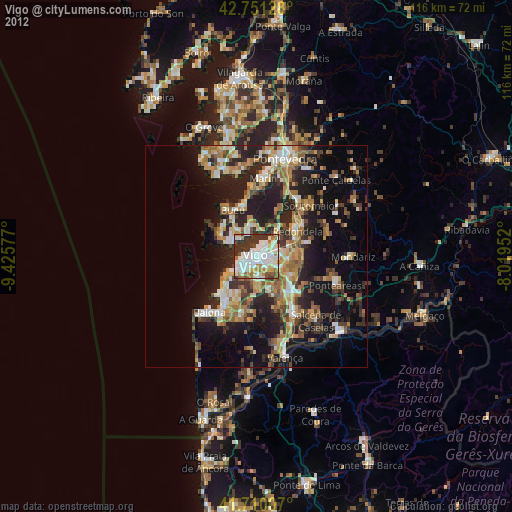
» Earth at Night: Flat Maps 2012, 2016