Puerto de la Cruz night lights from space
Night Light of Puerto de la Cruz (Canary Islands) from space (Spain) Src. Average luminocity for 10x10km area is 50.5417% and for 50x50km: 14.5015%.
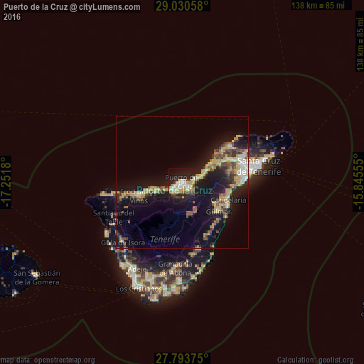
Analysis of Puerto de la Cruz night lights 2016
Square area 10x10 km:
 7.54%
7.54%90-99
11.9%80-89
11.9%70-79
10.71%60-69
1.79%50-59
3.37%40-49
4.17%30-39
4.17%20-29
15.28%10-19
24.21%0-9
4.96%Square area 50x50 km:
1.06%90-99
1.49%80-89
2.76%70-79
3%60-69
1.51%50-59
1.83%40-49
2.18%30-39
1.99%20-29
3.28%10-19
14.13%0-9
66.76%Clear (daylight) street map image can be seen on geolist.org.
Map coordinates:
29° 1' 50.1" North, 17° 15' 6.5" West
28° 24' 50.3" North, 16° 32' 55.2" West
27° 47' 37.5" North, 15° 50' 44" West
Some cities around Puerto de la Cruz sort by population:
• La Orotava
3.6 km =2.2 mi,  135°
135°
• Los Realejos
4.6 km =2.9 mi,  225°
225°
• Realejo Alto
5.5 km =3.4 mi,  221°
221°
• Santa Úrsula
6 km =3.7 mi,  77°
77°
• La Victoria de Acentejo
8.7 km =5.4 mi, 76°
• La Matanza de Acentejo
10.8 km =6.7 mi,  66°
66°
• La Guancha
11 km =6.8 mi,  245°
245°
• San Juan de la Rambla
10.2 km =6.3 mi,  256°
256°
2512196 (p: 32,219)
Sources (retrieved 2019-11-25):
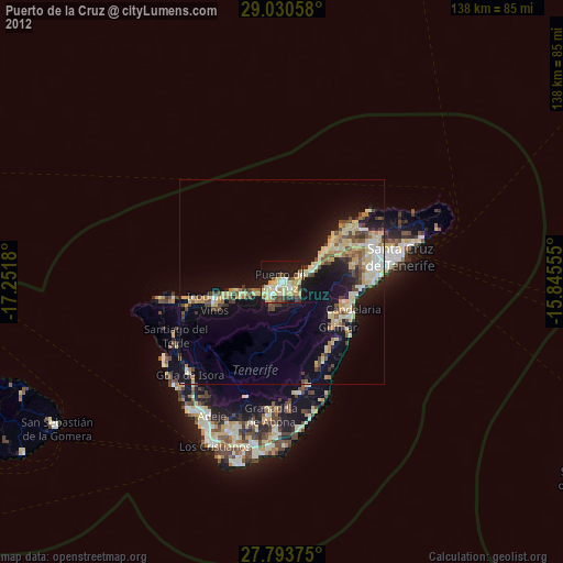
» Earth at Night: Flat Maps 2012, 2016