Martos night lights from space
Night Light of Martos (Andalusia) from space (Spain) Src. Average luminocity for 10x10km area is 16.4575% and for 50x50km: 4.9608%.
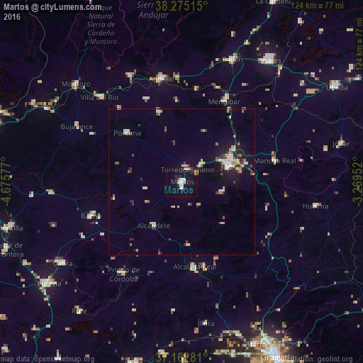
Analysis of Martos night lights 2016
Square area 10x10 km:
 3.74%
3.74%90-99
3.06%80-89
1.36%70-79
2.04%60-69
0.68%50-59
0.51%40-49
0.34%30-39
0.85%20-29
2.38%10-19
18.88%0-9
66.16%Square area 50x50 km:
0.51%90-99
0.8%80-89
0.77%70-79
0.69%60-69
0.47%50-59
0.5%40-49
0.42%30-39
0.67%20-29
0.76%10-19
3.38%0-9
91.03%Clear (daylight) street map image can be seen on geolist.org.
Map coordinates:
38° 16' 30.5" North, 4° 40' 32.8" West
37° 43' 15.9" North, 3° 58' 21.5" West
37° 9' 46.1" North, 3° 16' 10.3" West
Some cities around Martos sort by population:
• Jaén
16.9 km =10.5 mi,  71°
71°
• Torre del Campo
8.6 km =5.3 mi,  50°
50°
• Torredonjimeno
5.3 km =3.3 mi,  14°
14°
• Alcaudete
17.4 km =10.8 mi,  213°
213°
• Porcuna
25 km =15.5 mi,  311°
311°
• Arjona
24.8 km =15.4 mi,  343°
343°
• Los Villares
13.9 km =8.6 mi,  103°
103°
• Castillo de Locubín
21.6 km =13.4 mi,  172°
172°
2514073 (p: 24,655)
Sources (retrieved 2019-11-25):
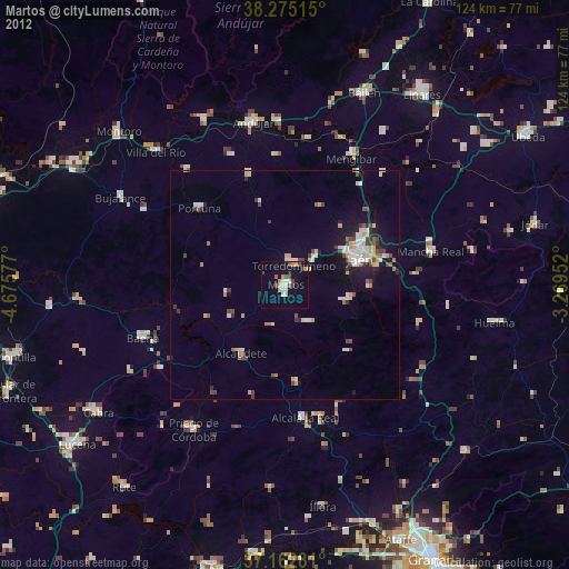
» Earth at Night: Flat Maps 2012, 2016