Los Alcázares night lights from space
Night Light of Los Alcázares (Murcia) from space (Spain) Src. Average luminocity for 10x10km area is 35.4082% and for 50x50km: 22.2597%.
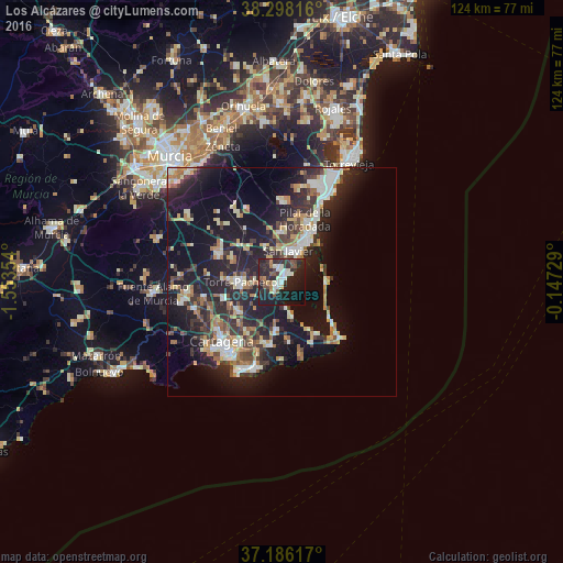
Analysis of Los Alcázares night lights 2016
Square area 10x10 km:
 5.78%
5.78%90-99
6.29%80-89
2.21%70-79
2.38%60-69
2.04%50-59
6.29%40-49
3.23%30-39
7.99%20-29
23.3%10-19
34.01%0-9
6.46%Square area 50x50 km:
2.86%90-99
3.64%80-89
2.3%70-79
2.66%60-69
3.29%50-59
1.98%40-49
2.81%30-39
4.31%20-29
9.26%10-19
19.32%0-9
47.59%Clear (daylight) street map image can be seen on geolist.org.
Map coordinates:
38° 17' 53.4" North, 1° 33' 12.7" West
37° 44' 39.3" North, 0° 51' 1.5" West
37° 11' 10.2" North, 0° 8' 50.2" West
Some cities around Los Alcázares sort by population:
• Torre-Pacheco
9.1 km =5.7 mi,  269°
269°
• San Javier
7 km =4.3 mi,  9°
9°
• Atamaría
16.5 km =10.3 mi,  166°
166°
• San Pedro del Pinatar
11.4 km =7.1 mi,  27°
27°
• Pilar de la Horadada
14.5 km =9 mi,  20°
20°
• La Unión
14.1 km =8.8 mi,  189°
189°
• La Manga del Mar Menor
16.4 km =10.2 mi,  134°
134°
• Santiago de la Ribera
7.1 km =4.4 mi, 34°
2514868 (p: 15,619)
Sources (retrieved 2019-11-25):
» Earth at Night: Flat Maps 2012, 2016