Vallejuelo night lights from space
Night Light of Vallejuelo (San Juan) from space (Dominican Republic) Src. Average luminocity for 10x10km area is 4.8017% and for 50x50km: 2.6763%.
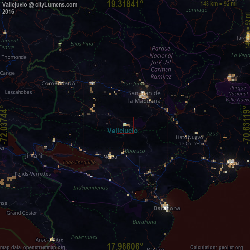
Analysis of Vallejuelo night lights 2016
Square area 10x10 km:
 0%
0%90-99
0.83%80-89
0%70-79
2.07%60-69
0.41%50-59
2.48%40-49
0%30-39
0.83%20-29
0%10-19
0%0-9
93.39%Square area 50x50 km:
0.02%90-99
0.4%80-89
0.38%70-79
0.4%60-69
0.48%50-59
0.46%40-49
0.25%30-39
0.81%20-29
0.32%10-19
0.87%0-9
95.6%Clear (daylight) street map image can be seen on geolist.org.
Map coordinates:
19° 19' 6.3" North, 72° 2' 14.8" West
18° 39' 12.7" North, 71° 20' 3.5" West
17° 59' 9.8" North, 70° 37' 52.3" West
Some cities around Vallejuelo sort by population:
• San Juan de la Maguana
20.2 km =12.6 mi,  32°
32°
• Las Matas de Farfán
31 km =19.3 mi,  321°
321°
• Neiba
21.2 km =13.2 mi,  205°
205°
• Villa Jaragua
24 km =14.9 mi,  221°
221°
• Tamayo
31.9 km =19.8 mi,  154°
154°
• Galván
16.8 km =10.4 mi,  183°
183°
• Juan de Herrera
26.5 km =16.5 mi,  22°
22°
• Cercado Abajo
20.9 km =13 mi,  292°
292°
3492123 (p: 5,217)
Sources (retrieved 2019-11-25):
» Earth at Night: Flat Maps 2012, 2016