Miches night lights from space
Night Light of Miches (El Seíbo) from space (Dominican Republic) Src. Average luminocity for 10x10km area is 1.9524% and for 50x50km: 0.7965%.
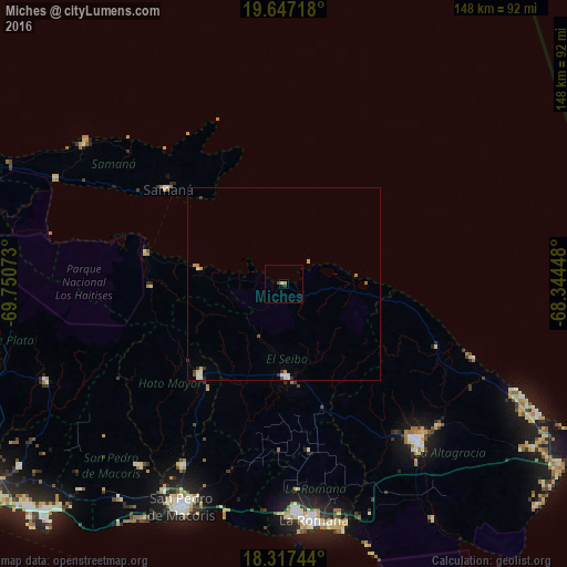
Analysis of Miches night lights 2016
Square area 10x10 km:
 0%
0%90-99
0%80-89
0.87%70-79
0%60-69
0.65%50-59
0.22%40-49
0%30-39
1.08%20-29
0.65%10-19
0.87%0-9
95.67%Square area 50x50 km:
0.11%90-99
0.16%80-89
0.11%70-79
0.1%60-69
0.16%50-59
0.07%40-49
0.06%30-39
0.18%20-29
0.1%10-19
0.03%0-9
98.92%Clear (daylight) street map image can be seen on geolist.org.
Map coordinates:
19° 38' 49.8" North, 69° 45' 2.6" West
18° 59' 1.1" North, 69° 2' 51.4" West
18° 19' 2.8" North, 68° 20' 40.1" West
Some cities around Miches sort by population:
• Salvaleón de Higüey
54.4 km =33.8 mi,  138°
138°
• Hato Mayor del Rey
33 km =20.5 mi,  221°
221°
• Santa Cruz de El Seibo
24.3 km =15.1 mi,  177°
177°
• Sabana de la Mar
36.8 km =22.9 mi,  283°
283°
• Samaná
39.2 km =24.4 mi,  309°
309°
• Guaymate
44.6 km =27.7 mi,  170°
170°
• Otra Banda
54.9 km =34.1 mi,  132°
132°
• El Valle
34.8 km =21.6 mi,  268°
268°
3496396 (p: 9,273)
Sources (retrieved 2019-11-25):
» Earth at Night: Flat Maps 2012, 2016