Wolgast night lights from space
Night Light of Wolgast (Mecklenburg-Vorpommern) from space (Germany) Src. Average luminocity for 10x10km area is 2.8775% and for 50x50km: 0.9818%.
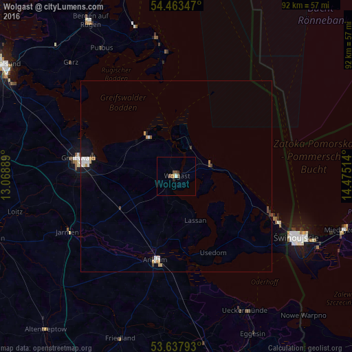
Analysis of Wolgast night lights 2016
Square area 10x10 km:
 0.13%
0.13%90-99
0.38%80-89
0.13%70-79
0.38%60-69
0.25%50-59
1.39%40-49
0.88%30-39
0.38%20-29
0.63%10-19
0%0-9
95.45%Square area 50x50 km:
0.17%90-99
0.2%80-89
0.11%70-79
0.09%60-69
0.11%50-59
0.12%40-49
0.14%30-39
0.08%20-29
0.05%10-19
0.62%0-9
98.32%Clear (daylight) street map image can be seen on geolist.org.
Map coordinates:
54° 27' 48.5" North, 13° 4' 8" East
54° 3' 9.9" North, 13° 46' 19.2" East
53° 38' 16.5" North, 14° 28' 30.5" East
Some cities around Wolgast sort by population:
• Greifswald
25.5 km =15.8 mi,  280°
280°
• Świnoujście, PL
34.9 km =21.7 mi,  116°
116°
• Anklam
22.5 km =14 mi,  193°
193°
• Ueckermünde
39.3 km =24.4 mi,  152°
152°
• Friedland
44.9 km =27.9 mi,  198°
198°
• Alt-Sanitz
29.2 km =18.1 mi, 204°
• Eggesin
46.1 km =28.6 mi, 154°
• Ostseebad Binz
40 km =24.9 mi,  344°
344°
2806501 (p: 12,664)
Sources (retrieved 2019-11-25):
» Earth at Night: Flat Maps 2012, 2016