Schmalkalden night lights from space
Night Light of Schmalkalden (Thuringia) from space (Germany) Src. Average luminocity for 10x10km area is 2.2366% and for 50x50km: 2.415%.
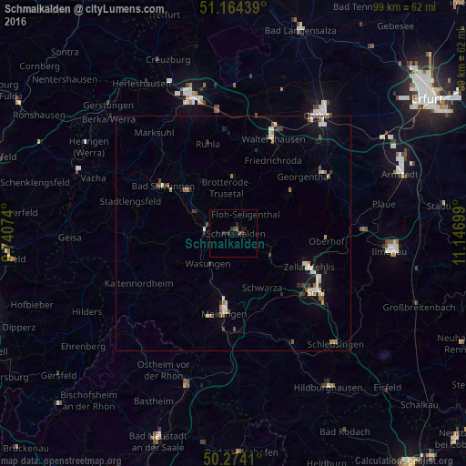
Analysis of Schmalkalden night lights 2016
Square area 10x10 km:
 0%
0%90-99
0%80-89
0%70-79
0%60-69
0.13%50-59
0.94%40-49
1.07%30-39
1.07%20-29
1.2%10-19
1.47%0-9
94.12%Square area 50x50 km:
0.26%90-99
0.49%80-89
0.26%70-79
0.21%60-69
0.22%50-59
0.34%40-49
0.29%30-39
0.27%20-29
0.38%10-19
1.49%0-9
95.8%Clear (daylight) street map image can be seen on geolist.org.
Map coordinates:
51° 9' 51.8" North, 9° 44' 26.7" East
50° 43' 16.9" North, 10° 26' 37.9" East
50° 16' 26.8" North, 11° 8' 49.2" East
Some cities around Schmalkalden sort by population:
• Meiningen
17.2 km =10.7 mi,  186°
186°
• Bad Salzungen
17.8 km =11.1 mi,  305°
305°
• Zella-Mehlis
16.9 km =10.5 mi,  115°
115°
• Waltershausen
21.2 km =13.2 mi,  22°
22°
• Ruhla
19.9 km =12.4 mi,  343°
343°
• Friedrichroda
17.4 km =10.8 mi,  29°
29°
• Breitungen
9.5 km =5.9 mi,  299°
299°
• Steinbach-Hallenberg
9 km =5.6 mi,  108°
108°
2838059 (p: 17,710)
Sources (retrieved 2019-11-25):
» Earth at Night: Flat Maps 2012, 2016