Schallstadt night lights from space
Night Light of Schallstadt (Baden-Württemberg) from space (Germany) Src. Average luminocity for 10x10km area is 22.2386% and for 50x50km: 8.4924%.
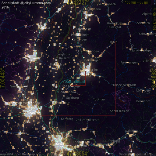
Analysis of Schallstadt night lights 2016
Square area 10x10 km:
 3.98%
3.98%90-99
3.55%80-89
2.56%70-79
2.27%60-69
1.42%50-59
2.7%40-49
4.83%30-39
1.85%20-29
2.98%10-19
17.05%0-9
56.82%Square area 50x50 km:
0.96%90-99
1.19%80-89
0.51%70-79
1.13%60-69
0.91%50-59
1.23%40-49
1.27%30-39
1.12%20-29
1.77%10-19
6.4%0-9
83.51%Clear (daylight) street map image can be seen on geolist.org.
Map coordinates:
48° 25' 38.2" North, 7° 3' 15.9" East
47° 57' 30.8" North, 7° 45' 27.2" East
47° 29' 7.9" North, 8° 27' 38.4" East
Some cities around Schallstadt sort by population:
• Freiburg
8.2 km =5.1 mi,  59°
59°
• Unterkrozingen
6.6 km =4.1 mi,  228°
228°
• Gundelfingen
12.3 km =7.6 mi,  40°
40°
• Ihringen
12.5 km =7.8 mi,  318°
318°
• Heitersheim
12 km =7.5 mi,  218°
218°
• Bötzingen
13.3 km =8.3 mi,  349°
349°
• Umkirch
8.3 km =5.2 mi,  4°
4°
• Münstertal/Schwarzwald
11.7 km =7.3 mi,  170°
170°
2840526 (p: 5,841)
Sources (retrieved 2019-11-25):
» Earth at Night: Flat Maps 2012, 2016