Hemau night lights from space
Night Light of Hemau (Bavaria) from space (Germany) Src. Average luminocity for 10x10km area is 2.631% and for 50x50km: 3.8269%.
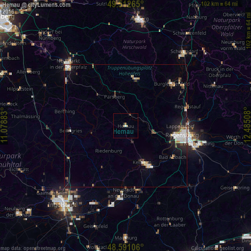
Analysis of Hemau night lights 2016
Square area 10x10 km:
 0.15%
0.15%90-99
0.45%80-89
0%70-79
1.19%60-69
0.6%50-59
0%40-49
0.6%30-39
0%20-29
0.3%10-19
0.89%0-9
95.83%Square area 50x50 km:
0.63%90-99
0.76%80-89
0.3%70-79
0.44%60-69
0.3%50-59
0.36%40-49
0.67%30-39
0.3%20-29
0.92%10-19
2.1%0-9
93.22%Clear (daylight) street map image can be seen on geolist.org.
Map coordinates:
49° 30' 45.5" North, 11° 4' 43.8" East
49° 3' 14.4" North, 11° 46' 55" East
48° 35' 27.8" North, 12° 29' 6.3" East
Some cities around Hemau sort by population:
• Kelheim
17 km =10.6 mi,  153°
153°
• Nittendorf
13.5 km =8.4 mi,  104°
104°
• Parsberg
12.7 km =7.9 mi,  338°
338°
• Sinzing
19.3 km =12 mi,  108°
108°
• Dietfurt
14.4 km =8.9 mi,  261°
261°
• Riedenburg
12.1 km =7.5 mi,  214°
214°
• Beratzhausen
5 km =3.1 mi,  23°
23°
• Seubersdorf
16.5 km =10.3 mi,  316°
316°
2906625 (p: 8,627)
Sources (retrieved 2019-11-25):
» Earth at Night: Flat Maps 2012, 2016